place

Crossbank

Areas of Greater ManchesterGeography of the Metropolitan Borough of OldhamGreater Manchester geography stubs

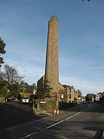
Crossbank is an area of Lees, a village in the Metropolitan Borough of Oldham, Greater Manchester, England. Historically a part of Lancashire, the name Crossbank is thought to derive from the days of the Knights Templar when a cross was etched into an earthen bank to denote lands granted to them. Prior to 1894, Crossbank had formed a hamlet linked with the parish of Ashton-under-Lyne, and lying within the Oldham parliamentary borough. Following the Local Government Act 1894, Crossbank constituted one of seven civil parishes within the Limehurst Rural District and administrative county of Lancashire. Unlike the other six parishes, Crossbank was an exclave of Limehurst lying to the north, bordering Lees and Waterhead in Oldham. In 1914, owing to urbanisation, the civil parish was abolished and its area incorporated into the Lees Urban District.

Excerpt from the Wikipedia article Crossbank (License: CC BY-SA 3.0, Authors).

Crossbank
Huddersfield Road,

Geographical coordinates (GPS) Address Nearby Places
placeShow on map

Wikipedia: CrossbankContinue reading on Wikipedia

Geographical coordinates (GPS)

Latitude Longitude
N 53.548365 ° E -2.0685632 °
placeShow on map

Address

Huddersfield Road

Huddersfield Road
OL4 3QA , Austerlands
England, United Kingdom
mapOpen on Google Maps

Share experience

Nearby Places

Lees railway station

Lees railway station opened on 5 July 1856 at Lees, Lancashire, when the London and North Western Railway (L&NWR) opened the branch from Greenfield to Oldham.The station was located to the south-east of St. John Street, where it crossed the railway. There were two running lines with platforms on the outer sides connected by a footbridge. The main building was to the south of the line and was accessed by a ramp running down from the road over-bridge. To the south east of the station was a goods yard with a goods shed and between the station and the goods shed was a coal depôt. The goods yard was able to accommodate most types of goods including live stock and was equipped with a ten ton crane.Services Initially services ran to Oldham Mumps (L&NWR) and to Greenfield with some of these continuing to Delph. From 1 July 1862 trains were extended from Oldham Mumps to Oldham Clegg Street, later that year the L&NWR closed its Mumps station replacing it with Oldham Glodwick Road.By 1866 the station saw fourteen services in each direction (four on Sundays) of which three continued to Delph (none on Sundays). By 1922 the number of services had increased to about thirty-nine each way (there was some variation on Saturdays) of which eighteen continued to Delph (none on Sundays). In 1939 the LMS service was about the same with around thirty-eight services each way, with even more variation on Saturdays, twenty-one of which continued to Delph (except on Sundays).The station closed to passengers on 2 May 1955, when the Delph Donkey passenger train service to Delph via Greenfield was withdrawn. The station closed to goods traffic on 16 December 1963. The line remained open until 13 April 1964.Not far from the station, to the north east, was Lees Engine Shed which was open from 1878 to April 1964.Currently the line is a cyclepath and there is no evidence of the station remaining.