Beechwood, Runcorn

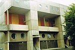
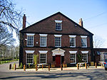
Beechwood is a residential area of Runcorn, England. It was designated as part of Runcorn's New Town in 1964 and allocated for private housing in the masterplan of 1967.Beechwood is served by the A5126 road to the north, and the A533 road to the east, the A557 road to the west, and the M56 motorway to the south. Floodbrook Clough, an ancient woodland and site of special scientific interest, cuts through the centre of the community. It is one of Cheshire's best examples of clough woodland on keuper marl. The small suburban community features Beechwood Primary School, a nursery, a private community centre, a pub, a public swimming pool, and a small Spar shop. Slightly further afield is the ecumenical church of St Marks, which is shared by both Anglicans and Methodists, as well as Hill View Primary School and a playground. The wooded area of Beech Wood is managed by the Woodland Trust.
Excerpt from the Wikipedia article Beechwood, Runcorn (License: CC BY-SA 3.0, Authors, Images).Beechwood, Runcorn
Arndale,
Geographical coordinates (GPS) Address Nearby Places Show on map
Geographical coordinates (GPS)
| Latitude | Longitude |
|---|---|
| N 53.316 ° | E -2.702 ° |
Address
Arndale 14
WA7 3HR , Beechwood
England, United Kingdom
Open on Google Maps


