Bennetts End
Areas of Hemel HempsteadEngvarB from April 2014Villages in Hertfordshire

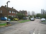
Bennetts End is a neighbourhood within Hemel Hempstead in Hertfordshire, England. It is located in the southeast of the town and consists almost entirely of public housing built as part of the new town in the 1950s. It was the second neighbourhood to have construction commenced by the New Town corporation, after the nearby Adeyfield.
Excerpt from the Wikipedia article Bennetts End (License: CC BY-SA 3.0, Authors, Images).Bennetts End
Bennetts Gate, Dacorum Bennetts End
Geographical coordinates (GPS) Address Nearby Places Show on map
Geographical coordinates (GPS)
| Latitude | Longitude |
|---|---|
| N 51.742193 ° | E -0.449064 ° |
Address
Bennetts Gate
HP3 8EW Dacorum, Bennetts End
England, United Kingdom
Open on Google Maps


