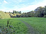
Maresfield
Ashdown ForestCivil parishes in East SussexEngvarB from June 2016Incomplete lists from June 2021Maresfield ... and 2 more
Villages in East SussexWealden District

Maresfield is a village and civil parish in the Wealden District of East Sussex, England. The village itself lies 1.5 miles (2.4 km) north from Uckfield; the nearby villages of Nutley and Fairwarp; and the smaller settlements of Duddleswell and Horney Common; and parts of Ashdown Forest all lie within Maresfield parish.
Excerpt from the Wikipedia article Maresfield (License: CC BY-SA 3.0, Authors, Images).Maresfield
Nursery Lane, Wealden Maresfield
Geographical coordinates (GPS) Address Nearby Places Show on map
Geographical coordinates (GPS)
| Latitude | Longitude |
|---|---|
| N 51 ° | E 0.09 ° |
Address
Nursery Lane
Nursery Lane
TN22 3BA Wealden, Maresfield
England, United Kingdom
Open on Google Maps


