Bramdean
City of WinchesterFormer civil parishes in HampshireHampshire geography stubsUse British English from August 2015Villages in Hampshire

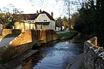
Bramdean is a village and former civil parish, now in the parish of Bramdean and Hinton Ampner, in the Winchester district, in the county of Hampshire, England. It is a linear settlement located along the busy A272 trunk road which was widened by the American troops in 1943 in preparation for D-Day.The village itself is peculiar due to the large number of large houses dating from the Georgian period, a few of these are set in/next to beautiful rolling parkland with specimen trees.
Excerpt from the Wikipedia article Bramdean (License: CC BY-SA 3.0, Authors, Images).Bramdean
Church Lane, Winchester Bramdean and Hinton Ampner
Geographical coordinates (GPS) Address Nearby Places Show on map
Geographical coordinates (GPS)
| Latitude | Longitude |
|---|---|
| N 51.04 ° | E -1.13 ° |
Address
Church Lane
SO24 0JS Winchester, Bramdean and Hinton Ampner
England, United Kingdom
Open on Google Maps


