place

High Falls, New York

Census-designated places in New York (state)Census-designated places in Ulster County, New YorkHamlets in New York (state)Hamlets in Ulster County, New YorkRosendale, New York
Use mdy dates from July 2023
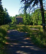
Downtown High Falls, NY

High Falls is a hamlet (and census-designated place) in Ulster County, New York, United States. The population was 700 at the 2020 census. Portions of High Falls are located in the towns of Marbletown, Rosendale, and Rochester.

Excerpt from the Wikipedia article High Falls, New York (License: CC BY-SA 3.0, Authors, Images).

High Falls, New York
State Highway 213,

Geographical coordinates (GPS) Address Nearby Places
placeShow on map

Wikipedia: High Falls, New YorkContinue reading on Wikipedia

Geographical coordinates (GPS)

Latitude Longitude
N 41.826944444444 ° E -74.122222222222 °
placeShow on map

Address

State Highway 213 1066
12440
New York, United States
mapOpen on Google Maps

Downtown High Falls, NY
Share experience

Nearby Places

Main Street Historic District (Stone Ridge, New York)

The Main Street Historic District in Stone Ridge, New York, United States, is located along US 209/NY 213 in that hamlet, part of the Town of Marbletown in Ulster County. It is a strip from the southern end of the unincorporated community to a short distance north of the intersection at Cooper Street, where the 209/213 concurrency ends. The latter highway turns left (northwest) towards the Catskill Mountains.Main Street's 70 acres (28 ha) contain 97 resources on 38 separate lots. All but five are contributing properties to the historic character of the district. In 1988, Main Street Historic District was added to the National Register of Historic Places. The buildings are mostly houses, dating from the 18th and early 19th centuries. The earlier structures are stone houses such as the Hasbrouck House at the district's southern boundary and the 1767 Cornelius Wynkoop Stone House, where George Washington once slept. Later buildings show the Federal and Greek Revival styles, such as the Tack Tavern, the Marbletown Dutch Reformed Church, and the town library (which was once the house of Edward Lounsbery). A few Craftsman and Victorian houses are scattered among the older homes. The entire strip has been relatively unchanged since the early 20th century, with the only significant addition being Marbletown's town hall and accompanying garages. From the earliest settlement of the area, development remained close to what was then the Old Mine Road. There were no side streets because the land on both sides of the road slopes down to unbuildable wetlands. Due to the short setback of the houses and other buildings, the lots—which range in size from one-quarter acre to more than twenty acres—appear smaller than they are. Many houses also have historic outbuildings in their rear. They are shielded from view of traffic along the street somewhat by the wooded character of the lots, which also makes the transition from country to town somewhat less abrupt for drivers approaching Stone Ridge along 209/213 from the south. Six black locust trees spaced 10 feet (3 m) apart along the frontage of the Wynkoop House, which was added to the National Register in its own right in 1996, were planted around the time it was built and are contributing aspects of its historic character.

Rosendale Trestle
Rosendale Trestle

The Rosendale Trestle is a 940-foot (290-meter) continuous truss bridge and former railroad trestle in Rosendale Village, a hamlet in the town of Rosendale in Ulster County, New York. Originally constructed by the Wallkill Valley Railroad to continue its rail line from New Paltz to Kingston, the bridge rises 150 ft (46 m) above Rondout Creek, spanning both Route 213 and the former Delaware and Hudson Canal. Construction on the trestle began in late 1870, and continued until early 1872. When it opened to rail traffic on April 6, 1872, the Rosendale trestle was the highest span bridge in the United States. The trestle was rebuilt in 1895 by the King Bridge Company to address public concerns regarding its stability, and it has been repeatedly reinforced throughout its existence. Concern over the sturdiness of the trestle has persisted since its opening, and was a major reason Conrail closed the Wallkill Valley rail line in 1977. After the rail line's closure, Conrail sold the bridge in 1986 for one dollar to John E. Rahl, a private area businessman, who tried unsuccessfully to operate the trestle as a bungee jumping platform in the 1990s. A similar attempt was made the following decade. The trestle was seized by the county in 2009 for tax nonpayment, and renovated as a pedestrian walkway for the Wallkill Valley Rail Trail. The deck and railings now continue all the way across the trestle, and access is from a parking lot about 1⁄4 mile (400 meters) north on Binnewater Road. It opened to the public with a celebration on June 29, 2013.