place

Setauket, New York

Brookhaven, New YorkCensus-designated places in New York (state)Census-designated places in Suffolk County, New YorkHamlets in New York (state)Hamlets in Suffolk County, New York
Populated coastal places in New York (state)Use mdy dates from August 2021
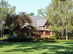
Setauket Presbyterian

Setauket is a hamlet and census-designated place (CDP) in the Town of Brookhaven, Suffolk County, New York, United States, on the North Shore of Long Island. As of the 2010 United States census, the CDP population, which at the time included East Setauket as well, was 15,477.Setauket was founded in 1655, the first settlement in what would become the town of Brookhaven. Prior to the 2020 census, the community was part of the Setauket-East Setauket CDP. The area was split in 2020 into two separate CDPs: Setauket and East Setauket.Setauket was founded as an agricultural community in the mid-17th century, and was a regional center of activity during the American Revolutionary War noted for the Culper spy ring and the Battle of Setauket. Many of Setauket's early structures are intact and now form the Old Setauket Historic District. The Setaukets remain a mostly residential area, while bordering the more commercial enclaves of Port Jefferson and Stony Brook. The handful of businesses within the community largely cater to the over 25,000 students of Stony Brook University, which is adjacent to the CDP.

Excerpt from the Wikipedia article Setauket, New York (License: CC BY-SA 3.0, Authors, Images).

Setauket, New York
Caroline Avenue,

Geographical coordinates (GPS) Address Nearby Places
placeShow on map

Wikipedia: Setauket, New YorkContinue reading on Wikipedia

Geographical coordinates (GPS)

Latitude Longitude
N 40.946388888889 ° E -73.111388888889 °
placeShow on map

Address

Caroline Avenue

Caroline Avenue
11733
New York, United States
mapOpen on Google Maps

Setauket Presbyterian
Share experience

Nearby Places

Frank Melville Memorial Park

The Frank Melville Memorial Park is a privately run, publicly accessible park surrounding the Melville Mill Pond in Setauket, New York. It was dedicated in 1937 to the memory of Frank Melville Jr., father of local philanthropist Ward Melville. The park was added to the National Register of Historic Places on July 19, 2010. The 24 acre park contains a walking trail and is also home to the Three Village Garden Club Arboretum, which is maintained by a group of local volunteers. A series of mills have inhabited the Mill Pond as early as 1660. The current mill house was built with the help of Donald A. Spetta in 1937 and contains a running simulated mill wheel which continues this historical legacy. The mill house also services as the park headquarters. Another historic structure is the Satterly Barn which was built in the early 1700s. A stable was added around 1937 and the structure was re-sided and re-roofed in 1968 under the direction of Ward Melville. Nearby is the John Satterly House which is claimed to be one of the oldest houses in the Setauket area. It was completely restored in 1968 by Ward Melville. Another property owned by the park foundation is the Bates House, a 1922 Colonial Revival-style house that was acquired in 1955. The house is rented by the foundation year round for special events. Sitting adjacent to the park on the East side is the Patriot's Hollow State Forest. It is home to "Patriot's rock", which was once a meeting place of the Setalcott Indians and the site of Reverend Nathaniel Brewster's first sermon. During the Revolutionary war, it was the site of a skirmish with Tory forces garrisoned in the nearby Presbyterian church on August 24, 1772. The property was sold to the Three Village Community Trust in 2010.