place

Carmel, New York

Towns in Putnam County, New YorkTowns in the New York metropolitan area
Carmel NY
Carmel NY

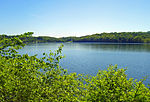
Carmel (pronounced ) is a town in Putnam County, New York, United States. As of the 2020 United States census, the town had a population of 33,576. The town may have been named after Mount Carmel in Israel. The Town of Carmel is on the southern border of Putnam County, abutting Westchester County, approximately 50 miles (80 km) north of New York City and 10 miles (16 km) west of Danbury, Connecticut. It has no incorporated villages, although the hamlets of Carmel and Mahopac each have populations sizable enough to be considered villages.

Excerpt from the Wikipedia article Carmel, New York (License: CC BY-SA 3.0, Authors, Images).

Carmel, New York
North Lake Boulevard,

Geographical coordinates (GPS) Address Nearby Places
placeShow on map

Wikipedia: Carmel, New YorkContinue reading on Wikipedia

Geographical coordinates (GPS)

Latitude Longitude
N 41.385 ° E -73.729444444444 °
placeShow on map

Address

North Lake Boulevard 624
10541
New York, United States
mapOpen on Google Maps

Carmel NY
Carmel NY
Share experience

Nearby Places

West Branch Reservoir

The West Branch Reservoir is a reservoir in the New York City water supply system. Formed by impounding the upper reaches of the West Branch of the Croton River, it is located in the Putnam County, New York, towns of Kent, and Carmel, about 50 miles (80 km) north of New York City.Put into service in 1895, West Branch is one of 12 reservoirs in the system's Croton Watershed, and second northernmost. It receives the flow of the upstream Boyds Corner impoundment, and, when needed, of Lake Gleneida, a controlled lake in the City supply system. Primarily, however, it receives water from the much larger Rondout Reservoir in the Catskill Mountains on the west bank of the Hudson River via the Delaware Aqueduct. It serves as a supplementary settling basin for these waters before releasing its flow back into the aqueduct to be carried to the Kensico Reservoir in southern Westchester County.West Branch Reservoir has a 20 square mile (32 km²) drainage basin, and can hold up to 8 billion US gallons (30,000,000 m3) of water at full capacity. It consists of two basins, separated by State Route 301.During drought periods the West Branch also receives water pumped in from the Hudson River by the City's Chelsea Pumping Station near Beacon in Dutchess County, some 65 miles (105 km) from New York City. It was used for this purpose during the 1965–66 and 1985 droughts, as well as during May 1989. Water withdrawn from the West Branch ordinarily flows via the Delaware Aqueduct to the Kensico Reservoir in Westchester County for further settling. There it mixes with additional Catskill system water carried by the Catskill Aqueduct before entering tunnels that carry it to the Hillview Reservoir in Yonkers, at the City's northern boundary. There it enters the city's direct water supply distribution system, flowing via tunnels through the boroughs of The Bronx, Queens, and Brooklyn. The water finally stops at Staten Island. Water in excess of New York City's needs at the West Branch Reservoir goes over its spillway and into the West Branch Croton River, which is captured downstream by the Croton Falls Reservoir.

West Somers Methodist Episcopal Church and Cemetery

The former West Somers Methodist Episcopal Church, also known as Tomahawk Chapel, is located on Tomahawk Street (part of New York State Route 118) in the town of Somers, New York, United States. It is a small wooden building in the Greek Revival architectural style built in the 1830s. Also on its lot is the cemetery where many of the early members were buried. In 2011 the church, cemetery and the stone wall that surrounds them were listed on the National Register of Historic Places. At the time of the church's construction, West Somers was a thriving agricultural community. Burials had begun in the cemetery almost a decade earlier; most of the area's congregants attended the established Mount Zion Methodist Church some distance away. One of West Somers's more prominent residents built the church so his neighbors would not always have to travel so far; it was so small that circus pioneer Hachaliah Bailey, also a Somers resident, likened it to a tiger's cage.Throughout the rest of the 19th century the church was a cornerstone of the West Somers community, with itinerant ministers leading services in the absence of a pastor (according to the United Methodist Church, successor to the Methodist Episcopal Church, the church was never a recognized congregation within the larger denomination). Its Sunday school classes were for a long time the only educational opportunity available to area children. Members continued to be buried in the cemetery; more than half lived to be over 70, an unusually high number for that region and era.Attendance and involvement declined in the early 20th century as West Somers felt the effects of suburbanization and the taking of large tracts of local land to create the reservoirs of the New York City water supply system. By the 1950s the church building had suffered such severe decline and neglect that its porch columns had to be replaced. Further restoration and renovation, including moving the church from its original site in the early 21st century, preceded the building's listing on the National Register.