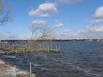
Brick Township, New Jersey

Brick Township is a township situated on the Jersey Shore within Ocean County, in the U.S. state of New Jersey. As of the 2020 United States census, the city retained its position as the state's 13th-most-populous municipality, with a population of 73,620, a decrease of 1,452 (−1.9%) from the 2010 census count of 75,072, which in turn reflected a decline of 1,047 residents (−1.4%) from its population of 76,119 at the 2000 census, when it was the state's 12th most-populous municipality.A majority of Brick Township is located on the mainland. Ocean Beaches I, II, and III are situated on the Barnegat Peninsula, a long, narrow barrier peninsula that separates Barnegat Bay from the Atlantic Ocean. The mainland and beach area of the town are not geographically adjacent. Brick Township was incorporated as a township by an act of the New Jersey Legislature on February 15, 1850, from portions of both Dover Township (now Toms River Township) and Howell Township. The township was named after Joseph Brick, the owner of Bergen Iron Works located on the Metedeconk River. Portions of the township were taken to form Point Pleasant Beach (May 18, 1886), Bay Head (June 15, 1886), Lakewood Township (March 23, 1892), Mantoloking (April 10, 1911) and Point Pleasant (April 21, 1920). In 1963, voters rejected a referendum that would have changed the township's name to "Laurelton".After hovering for years in the top five, in 2006, the township earned the title of "America's Safest City", out of 371 cities included nationwide in the 13th annual Morgan Quitno survey. Since the year 2000, Brick Township has been the safest "city" (population over 75,000) in New Jersey. In 2003 and 2004, Brick Township was ranked as the second safest city in the United States, after Newton, Massachusetts. In 2005, Brick Township had dropped down to the fifth safest "city" (population over 75,000) in the United States, before it rebounded to the top in 2006.
Excerpt from the Wikipedia article Brick Township, New Jersey (License: CC BY-SA 3.0, Authors, Images).Brick Township, New Jersey
Twin Oaks Drive,
Geographical coordinates (GPS) Address Nearby Places Show on map
Geographical coordinates (GPS)
| Latitude | Longitude |
|---|---|
| N 40.061736 ° | E -74.10962 ° |
Address
Twin Oaks Drive 244
08724
New Jersey, United States
Open on Google Maps


