place

Stockton, New Jersey

1898 establishments in New JerseyBorough form of New Jersey governmentBoroughs in Hunterdon County, New JerseyNew Jersey populated places on the Delaware RiverPopulated places established in 1898
Stockton, New JerseyUse American English from March 2020Use mdy dates from March 2020
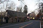
Stockton Inn, Stockton, NJ

Stockton is a borough in Hunterdon County, in the U.S. state of New Jersey. The borough sits on the Delaware River at the western end of Amwell Valley. As of the 2020 United States census, the borough's population was 495, a decrease of 43 (−8.0%) from the 2010 census count of 538, which in turn reflected a decline of 22 (−3.9%) from the 560 counted in the 2000 census.Stockton was incorporated as a borough by an act of the New Jersey Legislature on April 14, 1898, from portions of Delaware Township.

Excerpt from the Wikipedia article Stockton, New Jersey (License: CC BY-SA 3.0, Authors, Images).

Stockton, New Jersey
South Main Street,

Geographical coordinates (GPS) Address Nearby Places
placeShow on map

Wikipedia: Stockton, New JerseyContinue reading on Wikipedia

Geographical coordinates (GPS)

Latitude Longitude
N 40.405851 ° E -74.970627 °
placeShow on map

Address

South Main Street (Main Street)

South Main Street
18963
New Jersey, United States
mapOpen on Google Maps

Stockton Inn, Stockton, NJ
Share experience

Nearby Places

Stockton Borough School District

The Stockton Borough School District was a community public school district that served students in pre-Kindergarten through sixth grade from Stockton, in Hunterdon County, New Jersey, United States. As of the 2014-15 school year, the school is part of the South Hunterdon Regional School District, which also serves students from Lambertville and West Amwell Township. The school's student body of 43 made it the smallest operating school district in the State of New Jersey. Established in 1872, the district operated the oldest three-room schoolhouse in the state still in use, the District No. 98 Schoolhouse.In a special election held in September 2013, voters from Lambertville, Stockton and West Amwell Township passed referendums to dissolve (and recreate) the South Hunterdon Regional School District and to combine the three existing K-6 school districts from each municipality (Lambertville City School District, Stockton Borough School District and West Amwell Township School District), with majorities in each community passing both ballot items. A single combined regional district would be created, serving students in pre-Kindergarten through twelfth grade, in which property taxes would be levied under a formula in which 57% is based on property values and 43% on the number of students. The executive county superintendent will appoint an interim board of education for the new regional district, which will be responsible for implementing the merger.As of the 2011-12 school year, the district's one school had an enrollment of 43 students and 4.8 classroom teachers (on an FTE basis), for a student–teacher ratio of 8.96:1.The district was classified by the New Jersey Department of Education as being in District Factor Group "FG", the fourth-highest of eight groupings. District Factor Groups organize districts statewide to allow comparison by common socioeconomic characteristics of the local districts. From lowest socioeconomic status to highest, the categories are A, B, CD, DE, FG, GH, I and J.Public school students in seventh through twelfth grades attended the South Hunterdon Regional High School in Lambertville, part of the South Hunterdon Regional High School District, which also serves students from Lambertville and West Amwell Township attend South Hunterdon Regional High School.

Wickecheoke Creek

Wickecheoke Creek is a 15.0-mile-long (24.1 km) tributary of the Delaware River in Hunterdon County, New Jersey in the United States.It originates in Raritan Township on the Hunterdon Plateau and flows through Croton and Locktown before cascading off the Plateau where it passes under the Green Sergeant's Covered Bridge, one of the two last remaining covered bridges in the state. It cuts through part of the Amwell Valley and several steep sections of the Rosemont Valley before reaching the Delaware River. Before reaching the Delaware, it cuts through a low ridge and is joined by Plum Brook. Further south it and cuts through a second slightly larger ridge to the west of Sergeantsville. Rose Creek enters the creek two miles before it reaches the Delaware and Raritan Canal and the Delaware River at Prallsville. The Creek receives most of its water from springs as it passes through woodlands and farm fields. Water birds, eagles, beaver, and mink can be seen near the trout-stocked stream. Trails and narrow lanes along its banks also make it a favorite for artists, anglers, cyclists and hikers. The lower portion of what locals call "the Wick," runs through farms and forests protected by the New Jersey Conservation Foundation. The Foundation's Donald Jones Footpath follows the Creek for nearly two miles, just above Prallsville and the town of Stockton, New Jersey. The name Wickecheoke comes from a Unami word — wichkaachkwik, or "where there are birch trees".