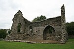
River Teifi
Pages with Welsh IPARiver navigations in the United KingdomRivers of CarmarthenshireRivers of CeredigionRivers of Pembrokeshire ... and 2 more
Sites of Special Scientific Interest in CeredigionUse British English from January 2018

The River Teifi (English: ; Welsh: Afon Teifi, pronounced [ˈavɔn ˈtei̯vi]) in Wales forms the boundary for most of its length between the counties of Ceredigion and Carmarthenshire, and for the final 3 miles (4.8 km) of its total length of 76 miles (122 km), the boundary between Ceredigion and Pembrokeshire. Its estuary is northwest of Cardigan, known in Welsh as Aberteifi, meaning 'mouth of the Teifi'. Teifi has formerly been anglicised as "Tivy".
Excerpt from the Wikipedia article River Teifi (License: CC BY-SA 3.0, Authors, Images).River Teifi
Coronation Drive,
Geographical coordinates (GPS) Address Website Nearby Places Show on map
Geographical coordinates (GPS)
| Latitude | Longitude |
|---|---|
| N 52.103 ° | E -4.689 ° |
Address
Coronation Drive
SA43 1PP
Wales, United Kingdom
Open on Google Maps


