place

National Park, New Jersey

1902 establishments in New JerseyBorough form of New Jersey governmentBoroughs in Gloucester County, New JerseyNational Park, New JerseyPopulated places established in 1902
Use American English from May 2020Use mdy dates from May 2020
JAMES WHITALL HOUSE GLOUCESTER CO.

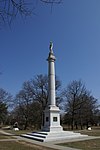
National Park is a borough in Gloucester County, New Jersey, United States. As of the 2010 United States Census, the borough's population was 3,036, reflecting a decline of 169 (−5.3%) from the 3,205 counted in the 2000 Census, which had in turn declined by 208 (−6.1%) from the 3,413 counted in the 1990 Census. Despite its name, National Park is neither a national park nor associated with one. The borough had the 18th-highest property tax rate in New Jersey, with an equalized rate of 4.446% in 2020, compared to 3.212% in the county as a whole and a statewide average of 2.279%.

Excerpt from the Wikipedia article National Park, New Jersey (License: CC BY-SA 3.0, Authors, Images).

National Park, New Jersey
Lakehurst Avenue,

Geographical coordinates (GPS) Address Nearby Places
placeShow on map

Wikipedia: National Park, New JerseyContinue reading on Wikipedia

Geographical coordinates (GPS)

Latitude Longitude
N 39.867297 ° E -75.185621 °
placeShow on map

Address

Lakehurst Avenue 303
08063
New Jersey, United States
mapOpen on Google Maps

JAMES WHITALL HOUSE GLOUCESTER CO.
Share experience

Nearby Places

Schuylkill River
Schuylkill River

The Schuylkill River ( SKOOL-kil, locally SKOO-kəl) is a river running northwest to southeast in eastern Pennsylvania, which was improved by navigations into the Schuylkill Canal. Several of its tributaries drain major parts of the center-southern and easternmost Coal Regions in the state. It flows for 135 miles (217 km) from Pottsville to Philadelphia, where it joins the Delaware River as one of its largest tributaries. In 1682 William Penn chose the left bank of the confluence upon which he founded the planned city of Philadelphia on lands purchased from the native Delaware nation. It is a designated Pennsylvania Scenic River, and its whole length was once part of the Delaware people's southern territories. The river's watershed of about 2,000 sq mi (5,180 km2) lies entirely within the state of Pennsylvania, the upper portions in the Ridge-and-valley Appalachian Mountains where the folding of the mountain ridges metamorphically modified bituminous into widespread anthracite deposits located north of the Blue Mountain barrier ridge. Millions of tons of coal from Pennsylvania's Anthracite Coal Region flowed by waterway and rail into Philadelphia to feed the iron and steel industry. The source of the Schuylkill's eastern branch is in heavily mined land, one ridgeline south of Tuscarora Lake along a drainage divide with the Little Schuylkill River, about a mile east of the village of Tuscarora and about a mile west of Tamaqua, at Tuscarora Springs in Schuylkill County. Tuscarora Lake is one source of the Little Schuylkill. The West Branch starts near Minersville and joins the eastern branch at the town of Schuylkill Haven. It then combines with the Little Schuylkill River downstream in the town of Port Clinton. The Tulpehocken Creek joins it at the western edge of Reading. Wissahickon Creek joins it in northwest Philadelphia. Other major tributaries include: Maiden Creek, Manatawny Creek, French Creek, and Perkiomen Creek. The Schuylkill joins the Delaware at the site of the former Philadelphia Navy Yard, now the Philadelphia Naval Business Center, just northeast of Philadelphia International Airport.