Plymouth Municipal Airport (New Hampshire)
Airports in New HampshireNew Hampshire building and structure stubsNew Hampshire transportation stubsNortheastern United States airport stubsPlymouth, New Hampshire ... and 1 more
Transportation buildings and structures in Grafton County, New Hampshire

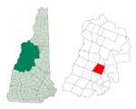
Plymouth Municipal Airport (FAA LID: 1P1) is a public airport located in Plymouth, New Hampshire, three miles (5 km) north-west of the central business district of Plymouth, in Grafton County, New Hampshire, United States. It is included in the Federal Aviation Administration (FAA) National Plan of Integrated Airport Systems for 2017–2021, in which it is categorized as a local general aviation facility.The airport is equipped with an AWOS III-PT which provides meteorological information to pilots and other interested parties.
Excerpt from the Wikipedia article Plymouth Municipal Airport (New Hampshire) (License: CC BY-SA 3.0, Authors, Images).Plymouth Municipal Airport (New Hampshire)
Quincy Road,
Geographical coordinates (GPS) Address Nearby Places Show on map
Geographical coordinates (GPS)
| Latitude | Longitude |
|---|---|
| N 43.779166666667 ° | E -71.753611111111 ° |
Address
Quincy Road
Quincy Road
03264
New Hampshire, United States
Open on Google Maps


