place

Pinkham's Grant, New Hampshire

Berlin, New Hampshire micropolitan areaTownships in Coös County, New HampshireTownships in New HampshireUse mdy dates from July 2023
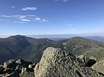
2016 09 03 17 17 55 View eastbound down the Mount Washington Auto Road at about mile 1.0 (about 2020 feet above sea level) in Pinkham's Grant Township, Coos County, New Hampshire

Pinkham's Grant is a township in Coös County, New Hampshire, United States. The grant lies entirely within the White Mountain National Forest. As of the 2020 United States census, the population of the grant was zero.In New Hampshire, locations, grants, townships (which are different from towns), and purchases are unincorporated portions of a county which are not part of any town and have limited self-government (if any, as many are uninhabited).

Excerpt from the Wikipedia article Pinkham's Grant, New Hampshire (License: CC BY-SA 3.0, Authors, Images).

Pinkham's Grant, New Hampshire
White Mountain Road,

Geographical coordinates (GPS) Address Nearby Places
placeShow on map

Wikipedia: Pinkham's Grant, New HampshireContinue reading on Wikipedia

Geographical coordinates (GPS)

Latitude Longitude
N 44.259722222222 ° E -71.250277777778 °
placeShow on map

Address

White Mountain Road 388
03581 (Pinkham's Grant)
New Hampshire, United States
mapOpen on Google Maps

2016 09 03 17 17 55 View eastbound down the Mount Washington Auto Road at about mile 1.0 (about 2020 feet above sea level) in Pinkham's Grant Township, Coos County, New Hampshire
Share experience

Nearby Places

Wildcat Mountain (New Hampshire)

Wildcat Mountain is a mountain located in Coos County, northern New Hampshire, United States. The mountain is part of the Carter-Moriah Range of the White Mountains, on the east side of Pinkham Notch. Wildcat Mountain faces Carter Dome across Carter Notch to the northeast, and Mount Washington across Pinkham Notch to the west. Wildcat Mountain has five summits — A, B, C, D, and E — along Wildcat Ridge, which curves two miles (3 km) to the south and west. Both A, at 4,422 feet (1,348 m), and D, at 4,062 feet (1,238 m), are considered "four-thousand footers". B, with an elevation of 4,305 feet (1,312 m), and C, at 4,285 feet (1,306 m), lack the topographic prominence to be considered more than subpeaks of Wildcat A. Likewise, the E peak, at 4,046 feet (1,233 m), is considered to be a subpeak of the higher D peak (the E peak was formerly believed to be the higher of the two, and used to appear on the official list of four-thousand footers, but current topographic maps reveal the D peak to be the higher summit). The Appalachian Trail, which extends over 2,170 miles (3,490 km) from Georgia to Maine, climbs up from the Appalachian Mountain Club's Joe Dodge Lodge in Pinkham Notch and traverses the summits of the Wildcat Ridge, continuing on to Carter Dome. The Wildcat Mountain Ski Area is one of the best-known alpine skiing resorts in New England, with lifts from the base on NH Route 16 in Pinkham Notch 2,112 ft (644 m) up to the D summit. The area has 49 trails on 225 acres (0.91 km2), including Polecat Trail—the longest ski trail in New Hampshire. The Wildcat Valley Trail, an ungroomed cross-country ski trail, leads from the summit down to Jackson, New Hampshire, dropping 3,240 ft (990 m) in 11.1 miles (17.9 km). Cut in 1972, it is one of the best-known routes in the extensive trail system maintained by the Jackson Ski Touring Foundation.

Mount Adams (New Hampshire)

Mount Adams, elevation 5,793 feet (1,766 m) above sea level, is a mountain in New Hampshire, the second highest peak in the Northeast United States after its nearby neighbor, Mount Washington. Located in the northern Presidential Range, Mount Adams was named after John Adams, the second President of the United States. It was given this name on July 31, 1820. To the northeast is Mount Madison and to the southwest is Mount Jefferson. From the summit, Mount Washington can be seen directly to the south. There are two major subsidiary peaks of Mount Adams: Mount Sam Adams and Mount Quincy Adams, named after John Adams' cousin, Revolutionary leader Samuel Adams, and son, President John Quincy Adams, respectively, and two minor sub-peaks, Abigail Adams (named for John Adams' wife Abigail) and Adams 5. The northern side of the mountain ridge is located in Low and Burbank's Grant, and the end of Durand Ridge, and King Ravine, on the north side of Mount Adams are in the town of Randolph (formerly Durand). The entire south side of the mountain ridge is in Thompson and Meserve's Purchase. The Appalachian Trail traverses the col between Mount Adams and Mount Sam Adams on the Gulfside Trail. The Randolph Mountain Club (RMC) maintains the trails and several huts and shelters high on Mount Adams' north side, including "The Perch", "Crag Camp", "The Log Cabin", and "Gray Knob". A large network of hiking and climbing paths lead south to the huts and ridges from several parking areas located on U.S. Highway 2. The Aetherius Society claims that Mount Adams is one of 19 "holy mountains" around the world.