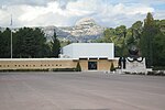
Garlaban
Bouches-du-Rhône geography stubsLandforms of Bouches-du-RhôneMountains of Provence-Alpes-Côte d'Azur

Garlaban is a hill which looks out to Aubagne. The summit is 715 metres high although its highest point is the butte des pinsots (731 m). It can be seen from most of the southern part of Bouches-du-Rhône, from Marseille to the valley of Huveaune, through to the motorway in Toulon and the one in Aix-en-Provence. In the past, seamen from Marseille used to look to it to find direction.
Excerpt from the Wikipedia article Garlaban (License: CC BY-SA 3.0, Authors, Images).Garlaban
Sentier des Dansaïres, Marseille
Geographical coordinates (GPS) Address Website Nearby Places Show on map
Geographical coordinates (GPS)
| Latitude | Longitude |
|---|---|
| N 43.331388888889 ° | E 5.5536111111111 ° |
Address
Garlaban - sud
Sentier des Dansaïres
13400 Marseille
Provence-Alpes-Côte d'Azur, France
Open on Google Maps


