Centennial Airport
Airports in ColoradoTransportation buildings and structures in Arapahoe County, ColoradoTransportation buildings and structures in Douglas County, Colorado

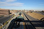
Centennial Airport (IATA: APA, ICAO: KAPA, FAA LID: APA) is a public use airport owned by the Arapahoe County Public Airport Authority in the Denver-Aurora metropolitan area, 15 nautical miles (17 mi, 28 km) southeast of downtown Denver, Colorado, United States. Located in Dove Valley, a census designated place in Arapahoe County, the airport's runways extend into Douglas County.
Excerpt from the Wikipedia article Centennial Airport (License: CC BY-SA 3.0, Authors, Images).Centennial Airport
South Peoria Street,
Geographical coordinates (GPS) Address External links Nearby Places Show on map
Geographical coordinates (GPS)
| Latitude | Longitude |
|---|---|
| N 39.57 ° | E -104.84944444444 ° |
Address
Centennial Airport
South Peoria Street 7800
80112
Colorado, United States
Open on Google Maps


