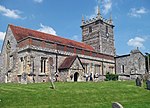
Downton, Wiltshire
Civil parishes in WiltshireOpenDomesdayVillages in Wiltshire

Downton is a village and civil parish on the River Avon in southern Wiltshire, England, about 6 miles (10 km) southeast of the city of Salisbury. The parish is on the county boundary with Hampshire and is close to the New Forest; it includes the villages of Wick and Charlton-All-Saints, and the small ancient settlement of Witherington. The Trafalgar Park estate erased the former settlement of Standlynch. The parish church, Trafalgar House, and two more houses are Grade I listed. Downton village is on the east bank of the river. Wick lies on the opposite bank, and is linked to Charlton by the A338 Poole–Oxfordshire road, which accompanies the river north–south through the parish.
Excerpt from the Wikipedia article Downton, Wiltshire (License: CC BY-SA 3.0, Authors, Images).Downton, Wiltshire
High Street,
Geographical coordinates (GPS) Address Nearby Places Show on map
Geographical coordinates (GPS)
| Latitude | Longitude |
|---|---|
| N 50.993 ° | E -1.743 ° |
Address
The Wooden Spoon
High Street
SP5 3PG
England, United Kingdom
Open on Google Maps


