Runnymede
Grasslands of the United KingdomHistory of EnglandMagna CartaMeadows in SurreyNational Trust properties in Surrey ... and 4 more
River ThamesUse British English from September 2013Water-meadowsWorks of Edwin Lutyens in England

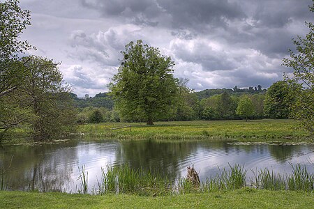
Runnymede is a water-meadow alongside the River Thames in the English county of Surrey, and just over 20 miles (32 km) west of central London. It is notable for its association with the sealing of Magna Carta, and as a consequence is, with its adjoining hillside, the site of memorials. Runnymede Borough is named after the area, Runnymede being at its northernmost point.
Excerpt from the Wikipedia article Runnymede (License: CC BY-SA 3.0, Authors, Images).Runnymede
Windsor Road, Borough of Runnymede
Geographical coordinates (GPS) Address Nearby Places Show on map
Geographical coordinates (GPS)
| Latitude | Longitude |
|---|---|
| N 51.444444444444 ° | E -0.56527777777778 ° |
Address
Windsor Road
SL4 2JL Borough of Runnymede
England, United Kingdom
Open on Google Maps


