Mattatuck State Forest
1926 establishments in ConnecticutClimbing areas of the United StatesConnecticut state forestsHarwinton, ConnecticutHiking trails in Connecticut ... and 8 more
Litchfield, ConnecticutParks in Litchfield County, ConnecticutParks in New Haven County, ConnecticutPlymouth, ConnecticutProtected areas established in 1926Thomaston, ConnecticutWaterbury, ConnecticutWatertown, Connecticut

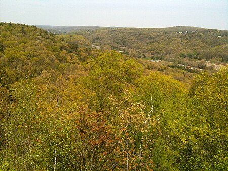
Mattatuck State Forest is a Connecticut state forest spread over twenty parcels in the towns of Waterbury, Plymouth, Thomaston, Watertown, Litchfield, and Harwinton. The Naugatuck River runs through a portion of the forest. The largest section of the forest is located about 1 mile (1.6 km) north of Waterbury. The Leatherman's Cave, named after the vagabond Leatherman of the late 19th century, is located in Thomaston near the Mattatuck Trail, 1/4 mile west of the junction with the Jericho Trail.
Excerpt from the Wikipedia article Mattatuck State Forest (License: CC BY-SA 3.0, Authors, Images).Mattatuck State Forest
Bidwell Hill Road,
Geographical coordinates (GPS) Address Nearby Places Show on map
Geographical coordinates (GPS)
| Latitude | Longitude |
|---|---|
| N 41.642777777778 ° | E -73.100555555556 ° |
Address
Bidwell Hill Road
Bidwell Hill Road
06795
Connecticut, United States
Open on Google Maps


