place

Johannes Miller House

Federal architecture in New York (state)Houses completed in 1771Houses in Orange County, New YorkHouses on the National Register of Historic Places in New York (state)National Register of Historic Places in Orange County, New York
Johannes Miller House

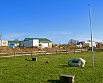
The Johannes Miller House is a Registered Historic Place in the Orange County, New York, Town of Montgomery. It is located on NY 211 just opposite its junction with NY 416 and another Registered Historic Place, the Harrison Meeting House Site and Cemetery. Orange County Airport is nearby. It was built originally as a Georgian in 1771 by Hans Smith, one of the early German settlers of the town. Twenty years later, Miller, a prosperous local businessman, acquired it and rebuilt it in the Federal style. In 1835, his descendants added some Greek Revival elements.

Excerpt from the Wikipedia article Johannes Miller House (License: CC BY-SA 3.0, Authors, Images).

Johannes Miller House
Dunn Road,

Geographical coordinates (GPS) Address Nearby Places
placeShow on map

Wikipedia: Johannes Miller HouseContinue reading on Wikipedia

Geographical coordinates (GPS)

Latitude Longitude
N 41.511944444444 ° E -74.253333333333 °
placeShow on map

Address

Dunn Road 330
12549
New York, United States
mapOpen on Google Maps

Johannes Miller House
Share experience

Nearby Places

Bodine's Bridge
Bodine's Bridge

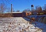
Bodine's Bridge carries New York State Route 211 across the Wallkill River, a mile (1.6 km) south (west by the highway's signed direction) of the village of Montgomery, New York, United States, near Orange County Airport. At 340 feet (103 m) in length, the steel through truss is the longest bridge along Route 211. The current bridge was built in 2015. Its predecessor dated to 1933, with a reconstruction in 1970. All the bridges at the location have been named after nearby, still-standing Bodine's Tavern, a popular rest stop on the early 19th century Minisink to Montgomery Turnpike, which later became Route 211. The house, now listed on the National Register of Historic Places, was built near a popular ford along the river, which the bridges were built over. Due to the bridge's location in the river's flood plain, it is often closed after heavy rains when its approaches, particularly to the south, are overrun by rising waters. This happened most recently during the April 2007 Nor'easter.In summer 2015 the state Department of Transportation began replacing the bridge. Route 211 was closed through the bridge at the beginning of June; traffic was detoured via Goshen Turnpike (County Route 101) in the Town of Wallkill through the hamlet of Scotchtown to State Route 17K via Scotchtown–Collabar Road (County Route 47). The new bridge, completed and opened in September of that year, has three continuous spans, two 12-foot (3.7 m) travel lanes and 6-foot (1.8 m) shoulders. The project was estimated to have cost $8.1 million; it is being paid for by a Federal Emergency Management Agency grant program to replace old scour-prone bridges in areas subject to frequent flooding.

Muddy Kill
Muddy Kill

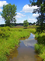
Muddy Kill is a 4.2-mile-long (6.8 km) tributary of the Wallkill River that runs entirely through the town of Montgomery in Orange County, New York, United States. It rises from a small pond just over a mile (1.7 km) west of the village of Walden, flowing first southwesterly then roughly due south to empty into the Wallkill just upstream from the village of Montgomery. Its course takes it mostly through areas cleared for agriculture, although not all are presently cultivated. Near its mouth it passes through a large horse farm, and then once it runs through a culvert under NY 17K it is within 102 acres (41 ha) recently acquired and developed by the town as Benedict Farm Park. It drains the low-lying Comfort Hills to the west. The name is an English interpretation of Modder Kill, as it was called by early Dutch settlers in the region. In Dutch, Modder means "mud" or "slime", so the meaning of the creek's name stayed the same. The fertile lands of the creek's valley attracted many early settlers, and the houses of some, such as Abraham Dickerson, Jacob Bookstaver, Moses Mould and Wilhelm Schmitt, still stand. It has been equally attractive to contemporary real estate developers, and to lessen environmental impacts on the stream and the Wallkill watershed as a whole the Open Space Institute and the town cooperated in 2005 to obtain a permanent agricultural easement on the 227-acre (92 ha) Zylstra Farm, one of the largest properties along the creek. With little significant woodland in its valley, the creek can rise quickly when heavy rains fall. After the April 2007 Nor'easter, it flooded severely enough near its mouth that Route 17K had to be closed west of Montgomery for two days.