place

Luccombe, Isle of Wight

Hamlets on the Isle of WightIsle of Wight geography stubsShanklin
Luccombe, IW, UK
Luccombe, IW, UK

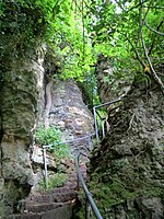
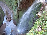
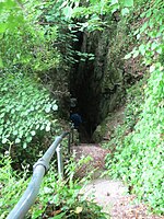
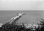
Luccombe is a hamlet a short distance south of Shanklin, on the south coast of the Isle of Wight, England. There is some indication of Bronze Age settlements on the top of the nearby hill of Luccombe Down.The Luccombe area features spectacular cliffs and scenery. It is a popular site for hang gliding and paragliding if there is an easterly wind of around 12 mph and it is low water, and on good days flights to Sandown and back can be achieved. Luccombe forms the east end of the Ventnor Undercliff region, which extends for 12 kilometres from Blackgang to Luccombe, also encompassing the town of Ventnor and the villages of Bonchurch, St Lawrence, and Niton. There is some concern that the Ventnor Undercliff area is experiencing substantial coastal erosion.Public transport is provided by Southern Vectis bus route 3, which runs between Newport, Ryde, Sandown, Shanklin and Ventnor.

Excerpt from the Wikipedia article Luccombe, Isle of Wight (License: CC BY-SA 3.0, Authors, Images).

Luccombe, Isle of Wight
The Green,

Geographical coordinates (GPS) Address Nearby Places
placeShow on map

Wikipedia: Luccombe, Isle of WightContinue reading on Wikipedia

Geographical coordinates (GPS)

Latitude Longitude
N 50.615 ° E -1.177 °
placeShow on map

Address

The Green

The Green
PO37 6RP
England, United Kingdom
mapOpen on Google Maps

Luccombe, IW, UK
Luccombe, IW, UK
Share experience

Nearby Places

Steel Bay
Steel Bay

Steel Bay is a bay on the south-east coast of the Isle of Wight, England. It lies to the east of the village of Bonchurch. It faces south-east towards the English Channel and has a one-half-mile (0.80 km) shoreline. It stretches from Bordwood Ledge in the north to Dunnose headland in the south. The bay is remote and has no established access. It is best viewed from Dunnose which can be accessed by scrambling over The Landslip, which is close to the Isle of Wight Coastal Path in the woods to the east of Upper Bonchurch. The bay has a large intertidal reef with outlying rocks, which can be a danger for marine traffic. Situated beneath Bonchurch Landslips, part of the wider Undercliff landslide complex, the cliffs are highly unstable and prone to landslides. The cliffs consist of sandstones from the uppermost sections of the Lower Greensand group overlain by the Gault Clay, with superficial deposits of landslide debris including material from the Upper Greensand and Chalk. The coastline saw major landslide events in 1810, 1818 and to a lesser extent in February 1995. In 1871, the Underley, a 1,292-ton iron-hulled sailing ship, ran around in a strong gale at the point between Monk's Bay and Steel Bay. She was on a voyage from London to Melbourne with thirty passengers and cargo on board, the vessel was lost but all her passengers and crew were saved bar one – a steward re-boarded the ship to rescue his pet bird and was washed overboard as it broke apart. Fragments of the wreck can still be seen by divers in the area when a gale has shifted the sands.