Trawsfynydd
Gwynedd electoral wardsPages with Welsh IPATrawsfynyddUse British English from March 2015

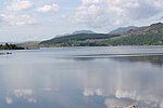
Trawsfynydd (Welsh pronunciation: [trausˈvənɨ̞ð]; Welsh for "across [the] mountain") is a linear village in Gwynedd, Wales, near Llyn Trawsfynydd reservoir, and adjacent to the A470 north of Bronaber and Dolgellau and 10 km (6 miles) south of Blaenau Ffestiniog. It also neighbours the towns of Porthmadog and Bala. The total community area is 12,010 hectares (46.4 square miles) with a population of only 973. The area is sparsely populated with each hectare (acre) inhabited by an average 0.07 (0.03) persons. The village is typical of many Welsh villages. The community includes the sub-regions of Bronaber, Cwm Prysor and Abergeirw, in addition to the village itself.
Excerpt from the Wikipedia article Trawsfynydd (License: CC BY-SA 3.0, Authors, Images).Trawsfynydd
Cefn Gwyn,
Geographical coordinates (GPS) Address Nearby Places Show on map
Geographical coordinates (GPS)
| Latitude | Longitude |
|---|---|
| N 52.902 ° | E -3.923 ° |
Address
Cefn Gwyn
Cefn Gwyn
LL41 4SG , Trawsfynydd
Wales, United Kingdom
Open on Google Maps


