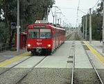
San Diego–Tijuana is an international transborder agglomeration, straddling the border of the adjacent North American coastal cities of San Diego, California, United States, and Tijuana, Baja California, Mexico. The 2020 population of the region was 5,456,577, making it the largest bi-national conurbation shared between the United States and Mexico, and the second-largest shared between the US and another country. The conurbation consists of the San Diego metropolitan area (defined as all of San Diego County), (2020 population 3,298,634) in the United States and the municipalities of Tijuana (2020 pop. 1,922,523), Rosarito Beach (126,980), and Tecate (108,440) in Mexico. It is the third most populous region in the California–Baja California region, smaller only than the metropolitan areas of Greater Los Angeles and the San Francisco Bay Area.
The largest centers of the urban area maintain global city status and as a whole the metropolitan region is host to 13 consulates from Asian, European, North American, Oceanian, and South American nations. Over fifty million people cross the border each year between Tijuana and San Diego, giving the region the busiest land-border crossing in the world. Since the implementation of the North American Free Trade Agreement (NAFTA) in 1994, San Diego–Tijuana has become a dominant commercial center in the United States and Mexico. The economic success of globalization has allowed San Diego–Tijuana to grow to the third richest region in the former Californias region, with a GDP of $136.3 billion in 2002. Renowned for natural beauty, tourism is a leading industry in the region and its coastal environs have been paramount factors in the growth of action sports-lifestyle companies. Other key industries include military, biotech, and manufacturing.
San Diego–Tijuana traces its European roots to 1542 when the land was explored by Portuguese explorers on behalf of imperial Spain. In 1601 it was mandated by the Spanish viceroy in Mexico City that safe ports be found, one of which would be San Diego Bay, for returning Spanish trade ships from Manila to Acapulco. During this mission, explorer Sebastián Vizcaíno was also told to map the California coast in great detail, leading to the further exploration of the modern-day site of San Diego–Tijuana. Since 2010, statewide droughts in California and in northern Mexico have further strained the San Diego–Tijuana binational region's water security.


