place

United States Custom House (San Ysidro, California)

Buildings and structures completed in 1933Buildings and structures in San DiegoCustom houses in the United StatesCustom houses on the National Register of Historic PlacesGovernment buildings on the National Register of Historic Places in California
Mission Revival architecture in CaliforniaNational Register of Historic Places in San DiegoWikipedia page with obscure subdivision
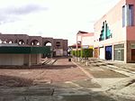
U.S. Custom House (San Ysidro, California) front

The United States Custom House (also known as the Old Customs House) in San Ysidro, San Diego, California, is a 1933 Spanish Revival building located 50 feet (15 m) north of the Mexico–United States border at the San Ysidro Port of Entry. It is listed on the National Register of Historic Places with the full historic name U.S. Inspection Station/U.S. Custom House and common name U.S. Custom House.

Excerpt from the Wikipedia article United States Custom House (San Ysidro, California) (License: CC BY-SA 3.0, Authors, Images).

United States Custom House (San Ysidro, California)
A Mexico/To Mexico, San Diego San Ysidro

Geographical coordinates (GPS) Address Nearby Places
placeShow on map

Wikipedia: United States Custom House (San Ysidro, California)Continue reading on Wikipedia

Geographical coordinates (GPS)

Latitude Longitude
N 32.5428 ° E -117.028 °
placeShow on map

Address

A Mexico/To Mexico
92173 San Diego, San Ysidro
California, United States
mapOpen on Google Maps

U.S. Custom House (San Ysidro, California) front
Share experience

Nearby Places

San Diego–Tijuana
San Diego–Tijuana

San Diego–Tijuana is an international transborder agglomeration, straddling the border of the adjacent North American coastal cities of San Diego, California, United States, and Tijuana, Baja California, Mexico. The 2020 population of the region was 5,456,577, making it the largest bi-national conurbation shared between the United States and Mexico, and the second-largest shared between the US and another country. The conurbation consists of the San Diego metropolitan area (defined as all of San Diego County), (2020 population 3,298,634) in the United States and the municipalities of Tijuana (2020 pop. 1,922,523), Rosarito Beach (126,980), and Tecate (108,440) in Mexico. It is the third most populous region in the California–Baja California region, smaller only than the metropolitan areas of Greater Los Angeles and the San Francisco Bay Area. The largest centers of the urban area maintain global city status and as a whole the metropolitan region is host to 13 consulates from Asian, European, North American, Oceanian, and South American nations. Over fifty million people cross the border each year between Tijuana and San Diego, giving the region the busiest land-border crossing in the world. Since the implementation of the North American Free Trade Agreement (NAFTA) in 1994, San Diego–Tijuana has become a dominant commercial center in the United States and Mexico. The economic success of globalization has allowed San Diego–Tijuana to grow to the third richest region in the former Californias region, with a GDP of $136.3 billion in 2002. Renowned for natural beauty, tourism is a leading industry in the region and its coastal environs have been paramount factors in the growth of action sports-lifestyle companies. Other key industries include military, biotech, and manufacturing. San Diego–Tijuana traces its European roots to 1542 when the land was explored by Portuguese explorers on behalf of imperial Spain. In 1601 it was mandated by the Spanish viceroy in Mexico City that safe ports be found, one of which would be San Diego Bay, for returning Spanish trade ships from Manila to Acapulco. During this mission, explorer Sebastián Vizcaíno was also told to map the California coast in great detail, leading to the further exploration of the modern-day site of San Diego–Tijuana. Since 2010, statewide droughts in California and in northern Mexico have further strained the San Diego–Tijuana binational region's water security.

Dorian's
Dorian's

Dorian's was a department store chain based in Tijuana, Baja California, Mexico. Dorian's was established in Downtown Tijuana in 1959.On November 9, 1977, a fire ripped through the block where Dorian's was located, however after only 17 working days the store was back open, with half the square footage housed in tent-like structures built in a nearby parking lot.Carlos Slim's Grupo Carso bought Dorian's Tijuana, S.A. de C.V. in 2004 and operated it as a subsidiary of Inmuebles Borgru, S.A. de C.V. which in turn was a subsidiary of Inmuebles Carso, S.A.B. de C.V. In that same year, Dorian's expanded to Cancun, Chihuahua, Leon, Merida, and Monterrey after purchasing five JCPenney stores, which operated in Mexico since 1995. A store opened in the new Las Misiones mall in Ciudad Juárez in 2004 and closed shortly thereafter (now Liverpool). In 2009, Dorian's had 14 stores in Tijuana: Downtown Tijuana (Corner of 2nd and Niños Héroes) Plaza Río Tijuana Plaza Carrousel Centro Comercial Mesa de Otay, Otay Centenario Cancun - Plaza Las Américas (formerly JCPenney) Chihuahua, Chihuahua - Plaza de Sol (formerly JCPenney) Ensenada - downtown La Paz, Baja California Sur - Downtown Forjadores León, Guanajuato - Plaza Mayor (formerly JCPenney) Mérida - Plaza las Américas (formerly JCPenney) Mexicali - Centro Comercial Cachanilla Monterrey area - San Pedro Garza García (formerly JCPenney) San Luis Río Colorado, SonoraStarting in April 2009, the 14 Dorian’s department stores were integrated into Sears México and operated under the name Sears. However, the Downtown Tijuana store was closed in May 2009 and is now the Plaza de la Tecnología, a market hall of retail technology vendors.

Zona Río
Zona Río

Zona Río (English: "River Zone") is an official zone, and the main modern business district, of the city of Tijuana, Mexico. Zona Río is located at a strategic point, in the north of the city, about 1 mile (1.6 km) from the U.S.-Mexico border and 9 miles (14 km) from Downtown San Diego. The Río Zone is within the Delegación Centro, or Central borough, of Tijuana. The old downtown of Tijuana, Zona Centro, borders Zona Río on the west. The Zona Río is home to most of the regional headquarters for commercial and financial businesses and health services. The city's largest mall, Plaza Río Tijuana, the central market, and the majority of Tijuana's larger hotels and upscale restaurants are also located here, along Zona Río's three main avenues, Paseo de los Héroes, Avenida Padre Kino and Boulevard General Rodolfo Sánchez Taboada. The Zona Río office space submarket had, in 2016, 111,059 square metres (1,195,430 sq ft) of class A and B office space, with another 25,043 square metres (269,560 sq ft) in the contiguous Agua Caliente submarket, for a total of 136,102 square metres (1,464,990 sq ft). As such, the area can be considered an edge city.Although being comparatively small in comparison with other Mexican cities main business districts, such as those of Monterrey and Guadalajara, Zona Río has notable skyscrapers, which due to the relative distance between them, are very prominent. The tallest buildings are the 28-story twin towers that are home for the Plaza Aguacaliente and Grand Hotel Tijuana, commonly known by locals as Las Torres or The Towers.