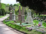
Knowle, Bristol

Knowle is a district and council ward in the south east of the city of Bristol in England, United Kingdom. It is bordered by Filwood Park to the west, Brislington to the east, Whitchurch and Hengrove to the south and Totterdown to the north. The settlement was mentioned in the Domesday Book as Canole. Knowle comes from the old English word for hillock, which means a little hill. The majority of amenities are located along Broadwalk Shopping Centre and Wells Road. Several sports clubs are located just south of the shopping centre, such as the Cricket, Tennis and Bowls clubs. The main green space is Redcatch Park, which contains football pitches, tennis courts, a croquet club and a children's play area. The park is protected and events are organised by the Friends of Redcatch Park. Redcatch Community Association run the Redcatch Centre in Redcatch Road, on the boundary of Redcatch Park – a resource for community groups and private and public events. Clubs and groups include the Knowle and Totterdown Local History Group, Redcatch Rollers (Short Mat Bowling), Redcatch Tea Dance, and Redcatch Art Club who all meet at Redcatch Community Centre. Knowle Community Association run a community centre in The Square, Knowle Park, with activities including Knowle East Youth Club. Other organisations are Broad Walk Neighbourhood Watch, which acts as a portal for the local community of Knowle and those in and around Broad Walk, and the St John Ambulance Knowle & Totterdown Division. There are good views of the city just above Perrett Park, along Sylvia Avenue which is lined by Victorian terraces.
Excerpt from the Wikipedia article Knowle, Bristol (License: CC BY-SA 3.0, Authors, Images).Knowle, Bristol
Broadwalk, Bristol Knowle
Geographical coordinates (GPS) Address Nearby Places Show on map
Geographical coordinates (GPS)
| Latitude | Longitude |
|---|---|
| N 51.434 ° | E -2.5721 ° |
Address
Broadwalk
BS4 2SE Bristol, Knowle
England, United Kingdom
Open on Google Maps


