Pyrmont, New South Wales
Green bansPyrmont, New South WalesSuburbs of SydneyUse Australian English from July 2011

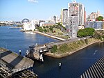
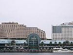
Pyrmont is an inner-city suburb of Sydney, in the state of New South Wales, Australia 2 kilometres south-west of the Sydney central business district in the local government area of the City of Sydney. It is also part of the Darling Harbour region. As of 2011, it is Australia's most densely populated suburb.Pyrmont was once a vital component of Sydney's industrial waterfront, with wharves, shipbuilding yards, factories and woolstores. As industry moved out, the population and the area declined. In recent years it has experienced redevelopment with an influx of residents and office workers.
Excerpt from the Wikipedia article Pyrmont, New South Wales (License: CC BY-SA 3.0, Authors, Images).Pyrmont, New South Wales
Upper Fig Street, Sydney Pyrmont
Geographical coordinates (GPS) Address Nearby Places Show on map
Geographical coordinates (GPS)
| Latitude | Longitude |
|---|---|
| N -33.87497 ° | E 151.19635 ° |
Address
Upper Fig Street
Upper Fig Street
2009 Sydney, Pyrmont
New South Wales, Australia
Open on Google Maps


