place

East Irondequoit Central School District

Education in Monroe County, New YorkSchool districts established in 1956School districts in New York (state)Use mdy dates from July 2023

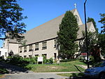
The East Irondequoit Central School District is a public school district in New York State that serves approximately 3,600 students in the eastern half of the town of Irondequoit in Monroe County. It has over 600 employees and an operating budget of $86,563,388. The average class size is 23 (K-5) and 24 (6-12) students. The student-teacher ratio is 13:1 (elementary) and 13:1 (middle-high school). Mary E. Grow is the Superintendent of Schools.

Excerpt from the Wikipedia article East Irondequoit Central School District (License: CC BY-SA 3.0, Authors).

East Irondequoit Central School District
Pardee Road, City of Rochester

Geographical coordinates (GPS) Address Nearby Places
placeShow on map

Wikipedia: East Irondequoit Central School DistrictContinue reading on Wikipedia

Geographical coordinates (GPS)

Latitude Longitude
N 43.1873 ° E -77.5521 °
placeShow on map

Address

Laurelton-Pardee Intermediate School

Pardee Road 600
14609 City of Rochester
New York, United States
mapOpen on Google Maps

Share experience

Nearby Places

Irondequoit Bay
Irondequoit Bay

Irondequoit Bay is a large body of water located in northeastern Monroe County, New York. The bay, roughly 0.5 miles (0.80 km) wide and 4 miles (6.4 km) in length, is fed by Irondequoit Creek to the south and flows into Lake Ontario at its northern end. On average, the surface of Irondequoit Bay rests at 245 feet (75 m) above sea level and is 80 feet (24 m) deep at its deepest point a short distance north of the Irondequoit Bay Bridge carrying the six-lane New York State Route 104 over the bay.The center of the bay acts as the eastern border for the town of Irondequoit and the western border of the towns of Penfield and Webster. The Irondequoit–Penfield boundary continues along the center of Irondequoit Creek south of the New York State Route 404 float bridge.During the past million years there were four glacial ages that covered the Rochester area with ice and impacted the geography of the area. The most recent glacier that left evidence here was about 100,000 years ago and it caused compression of the earth by as much as 2,500 feet (760 m). About 12,000 years ago, the area underwent massive changes, which included the rerouting of the Genesee River and other water bodies. Since the earth rebounded from the melting glaciers more rapidly in Canada than in New York, water from Lake Ontario was spilled over New York due to its lower elevation. During this time, the original outlet of the Genesee River was flooded out, creating Irondequoit Bay.On a French map of the area from 1688 titled "Le Lac Ontario" Irondequoit Bay was referred to as the "swamp of the Senecas". Prior to the 1840s, the bay was known as "Teoronto Bay."Seven parks abut the bay: Devil's Cove Park, Webster Ellison Park, Penfield Irondequoit Bay Marine Park, Irondequoit Abraham Lincoln Park (formerly Irondequoit Bay Park East), Penfield Irondequoit Bay Park West, Irondequoit LaSalle's Landing Park, Penfield Sandbar Park, Webster