Altstadt (Zürich)

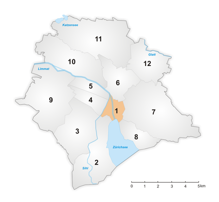
Die Altstadt (German for "the old town") in the Swiss city of Zürich encompasses the area of the entire historical city before 1893, before the incorporation of what are now districts 2 to 12 into the municipality, over the period 1893 to 1934. Die Altstadt approximately corresponds to the area enclosed by the former city ramparts, and is today within the administrative area of the city called Kreis 1 (District 1). With a population of 5,617 (as of 2015), it houses about 1.4% of the city's total population. Administratively, District 1 is divided into four parts or quarters by the Zürich statistical office, Rathaus (town hall), Hochschulen (universities), Lindenhof ("lime trees courtyard") and City. Lindenhof and Rathaus correspond to the parts of the medieval city left (west) and right (east) of the Limmat, respectively, while City and Hochschulen include the area of the Early Modern city west and east of the medieval walls, respectively.
Excerpt from the Wikipedia article Altstadt (Zürich) (License: CC BY-SA 3.0, Authors, Images).Altstadt (Zürich)
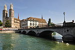
Münsterbrücke, Zurich Altstadt
Geographical coordinates (GPS) Address Nearby Places Show on map
Geographical coordinates (GPS)
| Latitude | Longitude |
|---|---|
| N 47.37 ° | E 8.542 ° |
Address
Münsterbrücke
Münsterbrücke
8001 Zurich, Altstadt
Zurich, Switzerland
Open on Google Maps


