Preston Capes
Civil parishes in NorthamptonshireNorthamptonshire geography stubsUse British English from March 2014Villages in NorthamptonshireWest Northamptonshire District

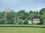
Preston Capes is a village and civil parish in West Northamptonshire in England. The population at the 2001 census was 188, including Canons Abbey and increasing to 216 at the 2011 census.The village's name means "Priest Farm/Settlement". The village was owned by Hugo filius Nicholai de Capes in 1234.The Church of England parish church is dedicated to St Peter and St Paul.
Excerpt from the Wikipedia article Preston Capes (License: CC BY-SA 3.0, Authors, Images).Preston Capes
Charwelton Road,
Geographical coordinates (GPS) Address Nearby Places Show on map
Geographical coordinates (GPS)
| Latitude | Longitude |
|---|---|
| N 52.1858 ° | E -1.1604 ° |
Address
Charwelton Road
Charwelton Road
NN11 3TA , Preston Capes
England, United Kingdom
Open on Google Maps


