place

Bryanston Square

Communal gardensGarden squares in LondonMarylebonePortman estateSquares in the City of Westminster
Use British English from January 2015
Bryanston Square geograph.org.uk 374401

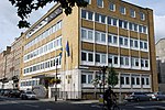
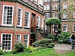
Bryanston Square is an 800-by-200-foot (244 by 61 m) garden square in Marylebone, London. Terraced buildings surround it — often merged, converted or sub-divided, some of which remain residential. The southern end has the William Pitt Byrne memorial fountain. Next to both ends are cycle parking spaces. The most notable merger is the Swiss Embassy at the north-east end. The square's narrow ends are broken by broad approach streets of the same British Regency date. More recent style flanks the mid-west range of the square in the form of №s 31, 32 and 33 which are three times an ordinary range of its widths, meaning the numbering scheme today skips ten following numbers, destroyed to make room for these, to culminate with №s 44 to 50 and the highest-numbered buildings of Great Cumberland Place – its corner houses, №s 63 and 68. That street, this square and Wyndham Place run broad and straight for 750 metres without building projections between an 1821-built church and Marble Arch, moved to its permanent site in 1851. Traffic circulates clockwise around the square and numbering runs anti-clockwise.

Excerpt from the Wikipedia article Bryanston Square (License: CC BY-SA 3.0, Authors, Images).

Bryanston Square
Bryanston Square, London Marylebone

Geographical coordinates (GPS) Address Nearby Places
placeShow on map

Wikipedia: Bryanston SquareContinue reading on Wikipedia

Geographical coordinates (GPS)

Latitude Longitude
N 51.5175 ° E -0.16083333333333 °
placeShow on map

Address

Bryanston Square

Bryanston Square
W1H 7TX London, Marylebone
England, United Kingdom
mapOpen on Google Maps

Bryanston Square geograph.org.uk 374401
Share experience

Nearby Places

34 Montagu Square, Marylebone

34 Montagu Square is the address of a London ground floor and basement flat once leased by Beatles member Ringo Starr during the mid-1960s. Its location is 1.3 miles (2.09 km) from the Abbey Road Studios, where The Beatles recorded. Many well-known people have lived at the address, including a British Member of Parliament, Richard-Hanbury Gurney, and the daughter of the Marquess of Sligo, Lady Emily Charlotte Browne. The square was named after Elizabeth Montagu, who was highly regarded by London society in the late 18th century. Paul McCartney recorded demo songs there, such as "I'm Looking Through You", and worked on various compositions, including "Eleanor Rigby". With the help of Ian Sommerville he converted the flat to a studio for Apple Corps' avant-garde Zapple label, recording William S. Burroughs for spoken-word Zapple albums. Jimi Hendrix and his manager, Chas Chandler, later lived there with their girlfriends. While living there, Hendrix composed "The Wind Cries Mary". For three months, John Lennon and Yoko Ono rented the flat, taking a photograph that would become the cover of their Two Virgins album. After the police raided the flat looking for drugs, the landlord of the property sought an injunction against Starr to prevent it from being used for anything untoward or illegal. Starr sold the lease in February 1969. In 2010, after a 10-year campaign by proposer, Peter Davies, English Heritage agreed to commemorate John Lennon's London address with a blue marker plaque at the site, making it an English Heritage "building of historical interest". On 23 October 2010, Yoko Ono unveiled the plaque with the inscription 'JOHN LENNON Musician and Songwriter 1940 - 1980 lived here in 1968'. 34 and the adjoining 33 Montagu Square have been listed Grade II on the National Heritage List for England since December 1987.

Seymour Place
Seymour Place

Seymour Place is a street in Marylebone in Central London. Located in the City of Westminster, it runs north from Seymour Street until it meets Marylebone Road, where it becomes Lisson Grove. It is crossed by Crawford Street, George Street, and York Street and runs parallel to Gloucester Place, which lies to its east. Its southern end is about 180 metres northwest of Marble Arch and about 40 metres east of Edgware Road. Seymour Place was created when the former Portman Estate was redeveloped into a largely grid-like residential pattern in the eighteenth century to accommodate the growing population of London. Along with Seymour Street, Seymour Place is named for Anne Seymour, the mother of Henry Portman, who redeveloped the area. From 1849 to 1952, the Gothic St Luke's Church stood the street and the adjoining Nutford Place; the church, which was badly damaged during the Second World War, now houses the Sylvia Young Theatre School. The northern end of the street was formerly named Stingo Lane, after the Yorkshire Stingo public house, until it was demolished and rebuilt in 1872 as an extension of the existing Seymour Place. In 1866, a pioneering female doctor, Elizabeth Garrett Anderson, opened St Mary's Dispensary in the street. From 1896 to 1961, the Marylebone Police Court was at 163 Seymour Place; this was near the county court on the corner of Seymour Place and Marylebone Road, and in 1961 the police court was closed and moved next door to the County Court.The house of Emma Cons, a Victorian social reformer, stands in Seymour Street and bears a blue plaque.The Rwandan High Commission stands in the street. The Seymour Place swimming baths were designed by Alfred Cross in 1931 for Marylebone Council and today are known as Seymour Leisure Centre or Seymour Hall. The place was refurbished in 2018.