place

South Ashburnham, Massachusetts

Census-designated places in MassachusettsCensus-designated places in Worcester County, MassachusettsUse mdy dates from July 2023Worcester County, Massachusetts
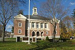
South Main Street, South Ashburnham, MA

South Ashburnham is a census-designated place (CDP) in the town of Ashburnham in Worcester County, Massachusetts, United States. The population was 1,062 at the 2010 census.

Excerpt from the Wikipedia article South Ashburnham, Massachusetts (License: CC BY-SA 3.0, Authors, Images).

South Ashburnham, Massachusetts
Mele Avenue,

Geographical coordinates (GPS) Address Nearby Places
placeShow on map

Wikipedia: South Ashburnham, MassachusettsContinue reading on Wikipedia

Geographical coordinates (GPS)

Latitude Longitude
N 42.613888888889 ° E -71.931388888889 °
placeShow on map

Address

Mele Avenue

Mele Avenue
01430
Massachusetts, United States
mapOpen on Google Maps

South Main Street, South Ashburnham, MA
Share experience

Nearby Places

Gardner Uptown Historic District

The Gardner Uptown Historic District is a historic district encompassing the former civic heart of Gardner, Massachusetts. The 65-acre (26 ha) area includes the old town common, an early cemetery, and a modest number of non-residential buildings among a larger number of houses. The area was the center of civic life from the incorporation of Gardner in 1785 until municipal functions were moved to West Gardner beginning in the late 1920s. The district was listed on the National Register of Historic Places in 1999.The focal center of the district is the old town green, and the brick Victorian Gothic First Congregational Church. The green is adjacent to a major local road junction, a small rotary where Elm, Pearl, Green, and Central Streets meet. The district radiates along these streets, with additional properties on the adjacent sections of Woodland Avenue and Heywood Street, which abut on the common and the old cemetery.Most of the buildings in the district date to the 19th century, with the majority of houses exhibiting either Greek Revival or Colonial Revival styling. Among the earliest buildings is the First Minister's House at 186 Elm Street, a Georgian/Federal house built in 1792 for Rev. Jonathan Osgood. Prominent architect-designed buildings in the district include the Levi Heywood Memorial Library Building, which was, like the First Congregational Church, designed by Fuller & Delano of Worcester, and the Syndicate Block, one of the district's few commercial buildings, which was designed by George Clemence.