place

Chester, Massachusetts

Chester, MassachusettsSpringfield metropolitan area, MassachusettsTowns in Hampden County, MassachusettsTowns in MassachusettsUse mdy dates from May 2024
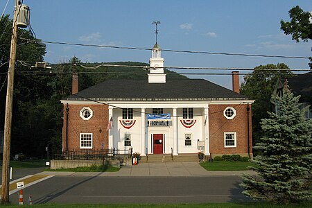
Chester Town Hall, MA

Chester is a town in Hampden County, Massachusetts, United States, situated in Western Massachusetts. It is part of the Springfield metropolitan statistical area. The town includes the Chester Factory Village Historic District. The total population was 1,228 in the 2020 census.

Excerpt from the Wikipedia article Chester, Massachusetts (License: CC BY-SA 3.0, Authors, Images).

Chester, Massachusetts
Maple Street,

Geographical coordinates (GPS) Address Nearby Places
placeShow on map

Wikipedia: Chester, MassachusettsContinue reading on Wikipedia

Geographical coordinates (GPS)

Latitude Longitude
N 42.279166666667 ° E -72.979166666667 °
placeShow on map

Address

Maple Street 14
01011
Massachusetts, United States
mapOpen on Google Maps

Chester Town Hall, MA
Share experience

Nearby Places

Chester Factory Village Historic District

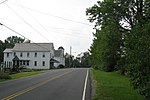
The Chester Factory Village Historic District is a historic district encompassing the historic village of Chester Factories in Chester, Massachusetts. Chester was settled in the 1760s, and the factory village was a location where water power was harnessed at an early time for grist mills and sawmills. The village got its name from the Chester Glass Factory, which operated in the area through the War of 1812. It benefited from the construction of a turnpike (now United States Route 20) leading to Chester Center in 1804, and was transformed by the arrival of the railroad around 1840. The village became an important provisioning stop for trains, and the village further benefited by the fact that the railroad bypassed Chester Center. The economic and civic life of the town gradually shifted, and Chester Factories is where the town hall and library were built. It was added to the National Register of Historic Places in 1989. The district is roughly bounded by Middlefield Road, River, Main, and Maple Streets, US 20, and Williams Street. The southern boundary is roughly US 20, with the tracks formerly of the Western Railroad the boundary to the northeast. There are some older houses in the area along US 20, while more intensive industrial development took place along the Westfield River branch which runs between the two transportation routes. The village's greatest period of growth was between 1879 and 1915, when the production of abrasive materials, and granite quarrying and cutting operations became major industries. The Fay's Clothing Store, built in 1896, is at three stories the village's tallest building.

Western Railroad Stone Arch Bridges and Chester Factory Village Depot

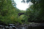
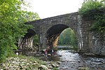
The Western Railroad Stone Arch Bridges and Chester Factory Village Depot is a National Historic Landmark District extending through parts of the towns of Chester, Middlefield, and Becket, Massachusetts. It encompasses a section of the historic Western Railroad railbed, two stone bridges constructed in the 1840s under the direction of George Washington Whistler, and the c. 1862 railroad depot in the village of Chester Factory, which served the railroad as an important logistics point for the difficult crossing of The Berkshires to the west. The section of railroad was the most expensive the company had to build, costing over $1 million in 1840. A hiking trail providing viewing points to the lower seven bridges was opened in 2004. All of the bridges are viewable via whitewater-appropriate watercraft from the river. These properties were designated a National Historic Landmark in 2021, in recognition of its importance in the development of railroad technologies. The graded crossing of the hills between Chester and the New York state line was an engineering challenge on a scale that had not previously been attempted by railroad engineers, and its success proved the ability of railroads to traverse steep grades using just friction. The railroad was also the first inter-regional railroad, connecting the network of eastern New England to that of upstate New York. The Chester Factory depot was an important stopping point for the railroad, where additional engines were added to westbound trains prior to traversing the steeper grades to the west. The Chester Factory depot is a contributing element of the Chester Factory Village Historic District. The two stone bridges included in the landmark designation, as well as the historic roadbed, are part of the Middlefield–Becket Stone Arch Railroad Bridge District; the bridges are listed as numbers 5 and 6 in that collection.

Middlefield–Becket Stone Arch Railroad Bridge District

The Middlefield–Becket Stone Arch Railroad Bridge District is a historic district extending through parts of the towns of Chester, Middlefield, and Becket, Massachusetts. The district encompasses a 3.7-mile (6.0 km) stretch of railroad right of way in which there are ten bridge crossings, including nine over the west branch of the Westfield River. The bridges were built in four time periods: 1840, 1866, 1912, and 1928. Nine of the ten bridges are stone or concrete masonry work, and one is a truss girder bridge. All are, with only minor exceptions, in excellent and original condition. The bridges were built to carry the Western Railroad through on its run from the Connecticut River to the Hudson River. This section of railroad was the most expensive the company had to build, costing over $1 million in 1840. The 1840 bridges were designed by George Washington Whistler, and constructed by the firm of Alexander Birney. Of the original nine stone bridges built, only three survive, all of which are now out of service. Some of the bridges were either demolished or encased in concrete during work performed in 1912 and 1927, and one bridge was demolished in 1927. One of the listed bridges (#4) was built of concrete in 1912, adjacent to one of the 1840 stone bridges (#3) that was taken out of service. The one steel truss bridge was built in 1912 by the Pennsylvania Steel Company. The district was added to the National Register of Historic Places in 1980. A hiking trail providing viewing points to the lower seven bridges was opened in 2004. All of the bridges are viewable via whitewater-appropriate watercraft from the river.