Dosthill
Areas of Tamworth, StaffordshireVague or ambiguous time from May 2011Villages in Staffordshire
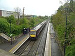
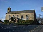
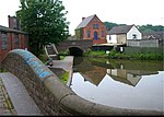
Dosthill is an area of Tamworth, Staffordshire, 2.5 miles south of the town centre, and close to the River Tame. The area is mostly residential, centering on Dosthill High Street, with local employment on the adjoining Tame Valley Industrial Estate. The High Street includes a public house called 'The Fox' and Dosthill Primary School (photo) which dates back to 1887.
Excerpt from the Wikipedia article Dosthill (License: CC BY-SA 3.0, Authors).Dosthill
School Lane,
Geographical coordinates (GPS) Address Nearby Places Show on map
Geographical coordinates (GPS)
| Latitude | Longitude |
|---|---|
| N 52.598 ° | E -1.684 ° |
Address
School Lane
B77 1DU , Dosthill
England, United Kingdom
Open on Google Maps


