Bolehall
Areas of Tamworth, StaffordshireStaffordshire geography stubs

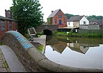
Bolehall is a village in Staffordshire, England, part of the Tamworth Conurbation. The village sits on the south bank of the River Anker. The parish of Bolehall and Glascote, was historically part of Warwickshire.
Excerpt from the Wikipedia article Bolehall (License: CC BY-SA 3.0, Authors, Images).Bolehall
Broadsmeath,
Geographical coordinates (GPS) Address Nearby Places Show on map
Geographical coordinates (GPS)
| Latitude | Longitude |
|---|---|
| N 52.62 ° | E -1.69 ° |
Address
Broadsmeath 85
B77 1DQ , Kettlebrook
England, United Kingdom
Open on Google Maps


