Wilnecote
Areas of Tamworth, StaffordshireFormer civil parishes in Staffordshire

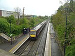
Wilnecote (pronounced Wilncutt) is a suburban area about two miles (3.2 km) south-east of Tamworth, in the Tamworth district, in the county of Staffordshire, England. It lies between the River Tame to the west and Kettle Brook to the north and east. It is one of the largest communities in the town. Wilnecote borders Hockley, Dosthill, Two Gates, Belgrave and Stonydelph.
Excerpt from the Wikipedia article Wilnecote (License: CC BY-SA 3.0, Authors, Images).Wilnecote
Wilnecote House Drive,
Geographical coordinates (GPS) Address Nearby Places Show on map
Geographical coordinates (GPS)
| Latitude | Longitude |
|---|---|
| N 52.60811 ° | E -1.6677 ° |
Address
Wilnecote House Drive
B77 5AQ , Wilnecote
England, United Kingdom
Open on Google Maps


