Sheppey Light Railway
Closed railway lines in South East EnglandGeographic coordinate listsHF StephensHistory of KentIsle of Sheppey ... and 9 more
Light railwaysLists of coordinatesRail transport in KentRailway lines closed in 1950Railway lines opened in 1901Railways on English IslandsStandard gauge railways in EnglandTransport in SwaleUse British English from February 2017

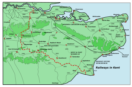
The Sheppey Light Railway was a railway on the Isle of Sheppey, Kent, England, which ran from Leysdown to Queenborough, where it connected with the South Eastern and Chatham Railway's Sheerness Line. It was engineered by Holman Fred Stephens and opened in August 1901 and closed on 4 December 1950. Originally there were stations at Sheerness East, East Minster on Sea, Minster on Sea, Eastchurch and Leysdown. Two halts were opened in 1905 at Brambledown and Harty Road.
Excerpt from the Wikipedia article Sheppey Light Railway (License: CC BY-SA 3.0, Authors, Images).Sheppey Light Railway
Borough of Swale Eastchurch
Geographical coordinates (GPS) Address Nearby Places Show on map
Geographical coordinates (GPS)
| Latitude | Longitude |
|---|---|
| N 51.3994 ° | E 0.838 ° |
Address
ME12 3SY Borough of Swale, Eastchurch
England, United Kingdom
Open on Google Maps


