Přerovská hůra
Central Bohemian Region geography stubsMountains and hills of the Czech RepublicNymburk District

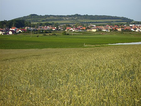
Přerovská hůra (historically also Bělice or Bílá hůrka) is a flat hill in the Central Bohemian Region of the Czech Republic. It is situated in the Central Elbe Table within the Polabí lowland. A fortification was built on the top of the hill during the Iron Age and was used by the Celts and early Slavs. The fortification is not dug out.
Excerpt from the Wikipedia article Přerovská hůra (License: CC BY-SA 3.0, Authors, Images).Přerovská hůra
Novopřerovská, okres Nymburk
Geographical coordinates (GPS) Address Nearby Places Show on map
Geographical coordinates (GPS)
| Latitude | Longitude |
|---|---|
| N 50.163888888889 ° | E 14.841666666667 ° |
Address
Novopřerovská
289 16 okres Nymburk, Přerov nad Labem
Central Bohemia, Czechia
Open on Google Maps


