place

Turkey Point Light

Lighthouses completed in 1833Lighthouses on the National Register of Historic Places in MarylandNational Register of Historic Places in Cecil County, MarylandTransportation buildings and structures in Cecil County, Maryland
Turkey Point Light USCG

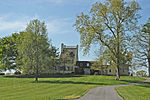
The Turkey Point Light is a historic lighthouse at the head of the Chesapeake Bay. Although only a 35-foot (11 m) tower, the 100-foot (30 m) height of the bluffs on which it stands makes it the third highest light off the water in the bay. It is also known for the large number of women who served as lightkeeper.

Excerpt from the Wikipedia article Turkey Point Light (License: CC BY-SA 3.0, Authors, Images).

Turkey Point Light
Turkey Point LightHouse Trail,

Geographical coordinates (GPS) Address External links Nearby Places
placeShow on map

Wikipedia: Turkey Point LightContinue reading on Wikipedia

Geographical coordinates (GPS)

Latitude Longitude
N 39.449882777778 ° E -76.008420277778 °
placeShow on map

Address

Turkey Point Light

Turkey Point LightHouse Trail
21901
Maryland, United States
mapOpen on Google Maps

linkWikiData (Q7855087)
linkOpenStreetMap (743256010)

Turkey Point Light USCG
Share experience

Nearby Places

Crystal Beach, Maryland

Crystal Beach (also known as White Crystal Beach) is an unincorporated community in Cecil County, Maryland, United States.Crystal Beach is a partnership between two brothers of the Green family. Kenneth "Gene" Eugene Green and Alfred "Dickie" Ernest Green (1933–2010). The community is inhabited seasonally with the majority of its inhabitants calling the Delaware Valley area their home. There are many large families there who have been frequenting the small private beach community for generations. Within the past five years, a small group of members have begun to coordinate events for the community to help raise funds to improve the quality of life at the small resort area. It is a prime location for boating and sunbathing. White Crystal Beach was founded in the mid-1930s by Alfred Ernest Green and his wife Ethel Pearsey Green at the site of Reybold's Wharf. The Green family had formerly owned a traveling carnival, then small amusement parks in Wilmington, Delaware, Penns Grove, New Jersey, and Charlestown, Maryland. The Green family created a summer-only, private rental resort on the Elk River and named it "White Crystal Beach". The Green family built bathhouses, a dance hall, beer garden, bowling alley, and even a tattoo parlor. Children's amusement park rides and an antique merry-go-round were brought from the traveling carnival, and a few dozen simple wooden cottages were built as rental units. Ernest and Ethel brought in their son Kenneth Green (wife Edna) and daughter Ella Green Crump to help run the concessions and manage the business. Eventually they were joined by their grandchildren, William, Dorcas, and Alfred Crump, along with "Gene", "Dickie", "Betty", and "Margie" Green, who all worked in various aspects of the family business. Alfred Ernest Green died in the late 1940s, and the management was passed on to his son Kenneth Green. The early 1950s brought some changes with damage from Hurricane Hazel in 1954, and a devastating fire in 1955. Ethel Green and her daughter Ella Green Crump Spence bought the farm property abutting the northern property line to renovate for their retirement, but Ella died in 1957, and Ethel retired to her second home in Florida, where she died in 1959. The farm property was passed to Ella's children and became "Elkview Shores". White Crystal Beach was then owned by Kenneth and Edna Green and managed with the help of their two sons, Kenneth "Gene" Green and Alfred "Dickie" Green.Alfred "Dickie" Green died in January 2010.

Susquehanna River National Wildlife Refuge

Susquehanna River National Wildlife Refuge is located on a small island 3.79 acres (15,300 m2) in size located at the mouth of the Susquehanna River in Harford County, Maryland. It is a satellite refuge managed by Blackwater National Wildlife Refuge. In the 1920s, the island was used as a fish hatchery to produce such species as shad. In the early 1940s, 13,363 acres (54.08 km2) of water in the Upper Chesapeake Bay were closed by Presidential Proclamations to the hunting of migratory waterfowl. These water areas were designated as the Susquehanna National Wildlife Refuge. At the time of its establishment, the water areas known as the Susquehanna flats were covered with wild celery, pondweeds, redhead grass and other desirable waterfowl foods. Peak waterfowl population numbers included over 500,000 canvasback and redhead ducks and over 200,000 American wigeon. These rich areas of aquatic growth began declining in the 1960s due to changes in the water quality and quantity. Development above the Conowingo Dam caused more rapid drainage and greater water flow through the dam. Currents in the upper Chesapeake Bay deposited heavy loads of silt in the Susquehanna flats area. What remained of the suitable waterfowl vegetation was destroyed when Hurricane Agnes moved through in 1972. Today, only a few thousand geese may be found around the refuge during the winter months. Because of the dramatic decrease in waterfowl numbers and vegetation in the area, the Presidential Proclamations were lifted on September 1, 1978 and the waters were returned to the State of Maryland. Battery Island remains a part of the National Wildlife Refuge System. The refuge has a surface area of 3.79 acres (0.0153 km2; 1.53 ha).