place

Tyringham Cobble

1963 establishments in MassachusettsHills of MassachusettsLandforms of Berkshire County, MassachusettsMountains on the Appalachian TrailOpen space reserves of Massachusetts
Protected areas established in 1963Protected areas of Berkshire County, MassachusettsThe Trustees of ReservationsTyringham, Massachusetts
Tyringham Cobble, Tyringham MA

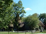
Tyringham Cobble is a 206-acre (83 ha) open space reservation located in Tyringham, Massachusetts on 411 m (1,348 ft) Cobble Hill in The Berkshires. It is managed by The Trustees of Reservations, a non-profit conservation organization, and is notable for its scenic views over the rural landscape of Tyringham Valley from rocky ledges and open fields. The reservation consists of the hill and surrounding agricultural and pasture land. In 2008, part of the 2,175 mile (3,500 km) Appalachian Trail was routed over the summit ledges.

Excerpt from the Wikipedia article Tyringham Cobble (License: CC BY-SA 3.0, Authors, Images).

Tyringham Cobble
Jerusalem Road,

Geographical coordinates (GPS) Address External links Nearby Places
placeShow on map

Wikipedia: Tyringham CobbleContinue reading on Wikipedia

Geographical coordinates (GPS)

Latitude Longitude
N 42.245 ° E -73.209166666667 °
placeShow on map

Address

Tyringham Cobble

Jerusalem Road
01264
Massachusetts, United States
mapOpen on Google Maps

linkWikiData (Q7861524)
linkOpenStreetMap (29785019)

Tyringham Cobble, Tyringham MA
Share experience

Nearby Places

Tyringham Cemetery
Tyringham Cemetery

Tyringham Cemetery is a historic cemetery section just outside the historic center of Tyringham, Massachusetts. The 3.67 acres (1.49 ha) property lies on the west side of Church Street, opposite the Union Church. The historically designated portion of the cemetery excludes a 4 acres (1.6 ha) parcel that was purchased in the 2000s.Housatonic Township #1, of which Tyringham was a part, was settled in 1739, and was incorporated as Tyringham in 1767. Its original town center is located in Monterey, which separated in 1847. The current town center developed around the first meeting house to be built in the northern section of the township, around 1779. Its precise location is not known, but is believed to be within the bounds of the cemetery; one potential location is indicated by a stone marker.The cemetery is ringed by an iron picket fence donated in 1892 by the Hale family. It contains more than 800 gravestones, dating from 1797 to the present. The earliest stones were generally made for marble, which was quarried from nearby Berkshire County towns, while later monuments were made of granite. An unusually large number of markers (fourteen) are made of "white bronze", marketed by the Monumental Bronze Company of Bridgeport, Connecticut between 1874 and 1914. Two unusual markers are in the shape of truncated tree trunks, their inscriptions incised on scrolls that appear to be suspended from the top of the marker; perhaps in a contrast to their elaborate nature, they commemorate working-class individuals. Prominent burials in the cemetery include members of the Garland and Hale families, both of which have lineage to the town's early settlers.