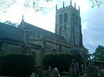
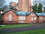
Greasley
Civil parishes in NottinghamshireEngvarB from May 2016Places in the Borough of BroxtoweVillages in Nottinghamshire

Greasley is a civil parish north west of Nottingham in Nottinghamshire, England. Although it is thought there was once a village called Greasley, there is no settlement of that name today as it was destroyed by the Earl of Rutland. The built up areas in the parish are Beauvale, Giltbrook, Moorgreen (often confused with Greasley), Newthorpe, Watnall and parts of Eastwood, Kimberley and Nuthall. There is also a small hamlet known as Bog-End. The parish is one of the largest in Nottinghamshire at 8.11 square miles (21.0 km2), and the 2001 UK Census reported it had a total population of 10,467, increasing to 11,014 at the 2011 Census.
Excerpt from the Wikipedia article Greasley (License: CC BY-SA 3.0, Authors, Images).Greasley
Church Road, Broxtowe
Geographical coordinates (GPS) Address Nearby Places Show on map
Geographical coordinates (GPS)
| Latitude | Longitude |
|---|---|
| N 53.02 ° | E -1.27 ° |
Address
Church Road
Church Road
NG16 2AB Broxtowe
England, United Kingdom
Open on Google Maps


