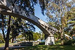
Annandale, New South Wales
Annandale, New South WalesInner West CouncilSuburbs of SydneyUse Australian English from December 2011

Annandale is a suburb in the Inner West of Sydney, in the state of New South Wales, Australia. Annandale is located within 5 kilometres west of the Sydney central business district and is part of the local government area of the Inner West Council. Annandale's northern end lies on Rozelle Bay, which is on Sydney Harbour. Glebe lies to its east, Lilyfield and Leichhardt to its west and Stanmore and Camperdown to its south.
Excerpt from the Wikipedia article Annandale, New South Wales (License: CC BY-SA 3.0, Authors, Images).Annandale, New South Wales
Johnston Street, Sydney Annandale
Geographical coordinates (GPS) Address Website Nearby Places Show on map
Geographical coordinates (GPS)
| Latitude | Longitude |
|---|---|
| N -33.881388888889 ° | E 151.17083333333 ° |
Address
Annandale Village Pharmacy
Johnston Street 107
2038 Sydney, Annandale
New South Wales, Australia
Open on Google Maps


