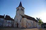
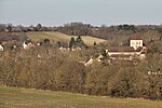
Parc naturel régional de la Brenne

The parc naturel régional de la Brenne (French pronunciation: [paʁk natyʁɛl ʁeʒjɔnal də la bʁɛn]; lit. 'Regional nature park of Brenne') is an 1,672 km2 (646 sq mi) large regional nature park located in the French department of Indre, France. It was founded December 22, 1982. Of old, La Brenne was a region in the old French provinces of Berry and Touraine, west of Châteauroux and east of Tournon-Saint-Martin. The park is cut in two by the river Creuse. Through the southern half flows the river Anglin. Historically, the southern part of the regional park is not really part of La Brenne. This part is called La petite Brenne. Historically, it was part of the Boischaut region. Like in all French national and regional parks, there still are people living in the park. The park has 47 communes, of which the capital is Le Blanc.
Excerpt from the Wikipedia article Parc naturel régional de la Brenne (License: CC BY-SA 3.0, Authors, Images).Parc naturel régional de la Brenne
D 17a, Le Blanc
Geographical coordinates (GPS) Address Nearby Places Show on map
Geographical coordinates (GPS)
| Latitude | Longitude |
|---|---|
| N 46.720833333333 ° | E 1.1736111111111 ° |
Address
D 17a
36300 Le Blanc
Centre-Val de Loire, France
Open on Google Maps


