Lefka, Patras
Neighborhoods in Patras

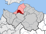
Lefka (Greek: Λεύκα, meaning: poplar) is a neighbourhood in the southern part of the Greek city of Patras, 5 km (3.1 mi) directly and 6 km (3.7 mi) south via road from downtown. It was originally called "Botovayia" ("Μποτοβάγια" in Greek). Lefka is linked with the Akti Dymaion (GR-9/E55 - Patras-Pyrgos-Kyparissia) and Akrotiriou Street (GR-3 - Patras-Tripoli southbound), Evias Street, Iteon Street and Lefkas Street. Lefka's residents work in agriculture, and the remainder work on other businesses.
Excerpt from the Wikipedia article Lefka, Patras (License: CC BY-SA 3.0, Authors, Images).Lefka, Patras
Πάροδος Ευβοίας 292, Municipal Unit of Patras
Geographical coordinates (GPS) Address Nearby Places Show on map
 Continue reading on Wikipedia
 Geographical coordinates (GPS)
| Latitude | Longitude |
|---|---|
| N 38.209 ° | E 21.7273 ° |
Address
Πάροδος Ευβοίας 292
Πάροδος Ευβοίας 292
263 33 Municipal Unit of Patras (2nd Community of Patras - Southern Sector)
Peloponnese, Western Greece and the Ionian, Greece
Open on Google Maps