Jerusalem Road 21
All pages needing cleanupRoads in IsraelStreets in Jerusalem

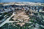
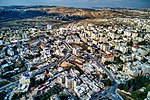
Jerusalem Road 21 is a road beginning at Highway 1 between Ramat Shlomo and Shu'afat northward to Beit Hanina and the Atarot Industrial Park. Plans call for a boulevard with two lanes in each direction. Construction is expected to cost NIS 112 million and was originally expected to be completed by January 2015. The first three sections of the road and part of the fourth section were completed in 2020.
Excerpt from the Wikipedia article Jerusalem Road 21 (License: CC BY-SA 3.0, Authors, Images).Jerusalem Road 21
Jerusalem Beit Hanina
Geographical coordinates (GPS) Address Nearby Places Show on map
Geographical coordinates (GPS)
| Latitude | Longitude |
|---|---|
| N 31.819444444444 ° | E 35.221944444444 ° |
Address
9752059 Jerusalem, Beit Hanina
Jerusalem District, Israel
Open on Google Maps


