Mill District, Minneapolis

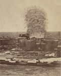
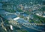
The Mill District is a neighborhood within Minneapolis, Minnesota, United States, and a part of the larger Downtown East neighborhood. The neighborhood contains several former flour mills left over from the days when Minneapolis was the flour milling capital of the world. With almost none of the mills still active, a number of these have been converted into condominiums leading to a revitalization of the neighborhood.Its approximate boundaries are the Mississippi River to the north, the I-35W Mississippi River bridge to the east, Washington Avenue to the south, and 5th Avenue to the west. It is bounded by Downtown West as well as the rest of the Downtown East neighborhoods. The Marcy-Holmes neighborhood is on the other side of the river, but there is no direct automobile connection between the two neighborhoods. There is a pedestrian and bicycle connection via the Stone Arch Bridge. The area also includes several cultural institutions, including the Guthrie Theater, the Mill City Museum as well as the MacPhail Center for Music. The area includes Mill Ruins Park, the new Gold Medal Park as well as the headquarters for the McKnight Foundation.
Excerpt from the Wikipedia article Mill District, Minneapolis (License: CC BY-SA 3.0, Authors, Images).Mill District, Minneapolis
South 2nd Street, Minneapolis
Geographical coordinates (GPS) Address Phone number Website Nearby Places Show on map
Geographical coordinates (GPS)
| Latitude | Longitude |
|---|---|
| N 44.978333 ° | E -93.256389 ° |
Address
Spoonriver
South 2nd Street 750
55401 Minneapolis
Minnesota, United States
Open on Google Maps


