RAF High Halden

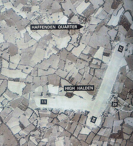
Royal Air Force High Halden or more simply RAF High Halden is a former Royal Air Force Advanced Landing Ground in Kent, England. The airfield is located approximately 8 miles (13 km) west-southwest of Ashford; about 50 miles (80 km) southeast of London. Opened in 1944, Ashford was a prototype for the type of temporary Advanced Landing Ground type airfield which would be built in France after D-Day, when the need for advanced landing fields would become urgent as the Allied forces moved east across France and Germany. It was used by the United States Army Air Forces. It was closed in September 1944. Today the airfield is a mixture of agricultural fields with no recognisable remains.
Excerpt from the Wikipedia article RAF High Halden (License: CC BY-SA 3.0, Authors, Images).RAF High Halden
Pot Kiln Lane,
Geographical coordinates (GPS) Address Nearby Places Show on map
Geographical coordinates (GPS)
| Latitude | Longitude |
|---|---|
| N 51.121388888889 ° | E 0.70444444444444 ° |
Address
Pot Kiln Lane
TN26 3HH , High Halden
England, United Kingdom
Open on Google Maps


