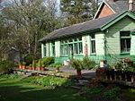
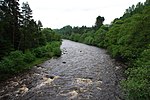
Allendale, Northumberland

Allendale, often marked on maps as Allendale Town, is a village and civil parish in south west Northumberland, England. It is located within the North Pennines Area of Outstanding Natural Beauty. At the 2001 census, the parish had a population of 2,120, decreasing to 2,021 at the 2011 Census. Allendale is within the North Pennines Area of Outstanding Natural Beauty (AONB); the second largest of the 40 AONB's in England and Wales. The local economy is predominantly based on agriculture (notably sheep farming) and tourism, although of late it has become a popular commuter town for Newcastle upon Tyne. Allendale is located around 11 miles (18 km) by road from the town of Hexham, and around 34 miles (55 km) from both Carlisle and Newcastle upon Tyne.
Excerpt from the Wikipedia article Allendale, Northumberland (License: CC BY-SA 3.0, Authors, Images).Allendale, Northumberland
Shield Street,
Geographical coordinates (GPS) Address Nearby Places Show on map
Geographical coordinates (GPS)
| Latitude | Longitude |
|---|---|
| N 54.896 ° | E -2.257 ° |
Address
Wesleyan Trinity Methodist Church
Shield Street
NE47 9BX , Allendale
England, United Kingdom
Open on Google Maps


