Haydon Bridge

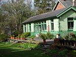
Haydon Bridge is a village in Northumberland, England, which had a population of 2,184 in the 2011 census. Its most distinctive features are the two bridges crossing the River South Tyne: the picturesque original bridge after which the village was named (now restricted to pedestrian use) and a modern bridge which used to carry the A69 road. A bypass was completed in 2009 and the A69 now bypasses the village to the south. The modern village is divided in two by the River South Tyne, whereas the old village (Haydon) was to the north, on the hill overlooking the river; all that remains is a Norman church now reduced in size from the original, which used stone taken from nearby Roman Hadrian's Wall. The A686 road joins the A69 just to the south east of the village, linking Haydon Bridge with Alston and Penrith.
Excerpt from the Wikipedia article Haydon Bridge (License: CC BY-SA 3.0, Authors, Images).Haydon Bridge
Ratcliffe Road,
Geographical coordinates (GPS) Address Website Nearby Places Show on map
Geographical coordinates (GPS)
| Latitude | Longitude |
|---|---|
| N 54.973 ° | E -2.247 ° |
Address
The Co-operative Food
Ratcliffe Road 4
NE47 6ET , Haydon
England, United Kingdom
Open on Google Maps


