place

Glasgow University RFC

1869 establishments in ScotlandClubs and societies of the University of GlasgowGlasgow stubsRugby clubs established in 1869Rugby union in Glasgow
Scottish rugby union team stubsScottish rugby union teamsSport at the University of GlasgowSports teams in GlasgowUniversity and college rugby union clubs in ScotlandUse British English from July 2015

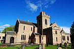
Glasgow University Rugby Football Club is a rugby union club at the University of Glasgow in Scotland. The men's side play in the university league; the women's side play in the Scottish Womens West One.

Excerpt from the Wikipedia article Glasgow University RFC (License: CC BY-SA 3.0, Authors).

Glasgow University RFC
Maryhill Road, Glasgow Temple

Geographical coordinates (GPS) Address Nearby Places
placeShow on map

Wikipedia: Glasgow University RFCContinue reading on Wikipedia

Geographical coordinates (GPS)

Latitude Longitude
N 55.903192 ° E -4.314476 °
placeShow on map

Address

Maryhill Road
G20 0TJ Glasgow, Temple
Scotland, United Kingdom
mapOpen on Google Maps

Share experience

Nearby Places

Glasgow University F.C.

Glasgow University Football Club are a Scottish football team that represents the University of Glasgow. The club was founded at a meeting of students "dissatisfied that the Rugby game alone has been played at College" on 7 December 1877, under the captaincy of Arthur Mechan.Having played previously in the Caledonian Amateur Football League, from the 2020–21 season, their first team will play in the newly formed West of Scotland Football League.They are based at the Garscube Sports Complex in Glasgow, The first team play out of Excelsior Stadium in Airdrie, which they share with Airdrieonians. They can participate in the Scottish Cup, as they are members of the Scottish Football Association. They lost in the first round to Brechin City in 2004–05, Buckie Thistle in 2007–08. and Vale of Leithen in 2008–09. Their participation in the 2004–05 competition was their first since 1995, when they lost 1–0 to Spartans in the first round. They also qualified for the 1975–76 competition, losing to Albion Rovers in a second round replay. Previously, on 28 January 1960, Glasgow University were routed 15–0 by Cup-holders St Mirren at their Love Street ground in a first-round tie, American-born striker Gerry Baker scoring ten of the goals. The 2010–11 competition saw Glasgow University qualify for the Scottish Cup second round for the first time since their 1975–76 defeat to Albion Rovers, after a 1–0 victory at Garscube Sports Complex against Burntisland Shipyard. In season 2015–16, Glasgow University were drawn away to Lowland League side Cumbernauld Colts in the first round of the competition, with Cumbernauld Colts winning 3–0 in front of a healthy crowd at Broadwood Stadium. In the 2016–17 competition, Glasgow University lost 8–2 to Junior champions Bonnyrigg Rose in a home tie staged at the Excelsior Stadium in Airdrie. University player William Beveridge made three international appearances for Scotland from 1879 to 1880.In addition to its main teams which are for current students of the university, there is also a club for graduates, Westerlands AFC, (founded in 1967 named after the institution's former sports grounds in Anniesland), who also play at Garscube and compete in the Caledonian AFL along with the Glasgow students' team.

Dawsholm Park
Dawsholm Park

Dawsholm Park is a public park in Glasgow, Scotland, adjoining the Kelvindale, Maryhill and Temple areas of the city, and southern parts of the town of Bearsden. It is situated on the River Kelvin, north of the River Clyde. The park covers an area of 33 hectares (82 acres), and consists mostly of woodland, with some grass and wildflower meadows in the southeast area of the park. The park was created from lands purchased by Glasgow City Council from Sir Archibald Campbell of Succoth, in 1922. As well as the woodland area (originally called the Belvidere plantation), the Council also purchased some grassy areas to the south of the woodland. Sir Archibald then gifted an area of land contaminated with oil shale waste adjoining the eastern boundary of the woodland. The council levelled and grassed over that area to form a recreation area laid out with football pitches.The woodland area of the park has always been kept in a natural state, and in 2007 Glasgow City Council designated the park as a Local Nature Reserve. As part of the environmental and ecological work in the park, Highland Cattle are being used in a managed grazing programme on the grassy areas, to encourage the development of wildflower meadows.The peripheries of the park include the University of Glasgow School of Veterinary Medicine, the institution's sporting facilities (Garscube Complex), the West of Scotland Science Park, and one of the four main waste recycling facilities in the city, serving its north-west sector.

Maryhill railway station

Maryhill railway station is a railway station serving the Maryhill area of Glasgow, Scotland. It is located on the Maryhill Line, 4+3⁄4 miles (7.6 km) northwest of Glasgow Queen Street, a short distance east of Maryhill Viaduct and Maryhill Park Junction. It has two side platforms. Services are provided by ScotRail on behalf of Strathclyde Partnership for Transport. Maryhill was previously the terminus for the eponymous line when it reopened by British Rail in 1993 - the original 1858 Glasgow, Dumbarton and Helensburgh Railway "Maryhill Park" station on the same site (also the junction for the former Kelvin Valley Railway and the Stobcross Railway to Partickhill & Queens Dock) had been closed back in October 1961 by the British Transport Commission although some workmen's trains continued until 1964 after which it was subsequently demolished. Since 2005 the service has extended to Kelvindale and Anniesland to connect with the North Clyde and Argyle Lines using a reinstated section of the former Stobcross Railway line that had previously been disused since 1980 (when the signal box that formerly controlled the junction was seriously damaged by fire) and then subsequently closed & dismantled. This extension was built to remove the need for terminating services from Queen Street to run empty through to Knightswood North Junction near Westerton in order to reverse before returning to Glasgow - a process that occupied the busy junction there for several minutes whilst the driver changed ends and crossed over from one track to the other. Ending this procedure allowed more trains on the North Clyde Line to pass through the junction, freeing up paths for services from the rebuilt branch line to Larkhall on the south side of the city to run via the Argyle Line through to Milngavie.

Anniesland Court
Anniesland Court

Anniesland Court is a 22-storey residential tower block in the Anniesland area of Glasgow, Scotland, designed by J Holmes & Partners and completed in 1968. It is the tallest listed building in Scotland, and is remarkably similar to Ernő Goldfinger's later and more famous Trellick Tower in London. It is the only tower block in Glasgow to have been granted a category A listing. Anniesland Court was designed by architecture firm John Holmes and Partner and was built in the first stage between 1966 and 1968, with additional work on the ground floor from 1984 to 1985.The building is unusual in that despite 22 storeys, the lift only has 7 stops. The design was meant to echo the structure of a traditional Glasgow Tenement lying on its side. Each of the 7 levels comprises 18 homes - 6 upstairs two-bedroom flats, 6 downstairs two-bedroom flats and 6 single one-room flats with level access off the main corridor. They have full kitchens and bathrooms the same as the two-bed flats. The upstairs and downstairs flats have their two bedrooms facing the rear of the building. On the rear or north facing elevation are the ‘drying’ balconies. These are illuminated at night with blue lights and they can be seen by passengers on their way to land at Glasgow Airport. Below the ‘tower’ on Crow Road level is the Glasgow City Council’s Financial Services Office and a branch office of the Glasgow Housing Association (GHA) Local Housing Organisation (LHO) Clydeside Tenant Partnership. Below this level is a basement garage underneath the building for residents use. There is also an outside car park to the south. The patio area to the front of the building is 3 levels above Great Western Road. To the east is a smaller building in a similar style, containing 24 homes. On the patio level, there are 8 two-bedroom maisonettes, above which are 16 flats. All have the same configuration as the main building. Below this smaller building and on Crow Road level is Anniesland Branch Library and Learning Centre. To the north of the library on Crow Road is the Anniesland Court Community Hall, refurbished during 2008, occupied by Anniesland Court Residents Association. The community hall provides a focus for the community and is used daily. It is open for residents to ‘drop in’ for a cup of tea and a chat. It is also the venue for the many evening functions throughout the year. Anniesland Court is part of the housing stock transferred to Glasgow Housing Association in 2003. The complex is managed by Great Western Tenant Partnership (GWTP). The building is lit at night with multicoloured "spider" floodlights to both gables and as above – the balconies. Anniesland Court sits in the Drumchapel/Anniesland Ward (Ward 14) of Glasgow City Council. The local councillors of that ward are presently Councillor Paul Carey, Bailie Patricia Ferguson, Councillor Fyeza Ikhlaq and Bailie Anne McTaggart.

New Kilpatrick
New Kilpatrick

New Kilpatrick, (also known as East Kilpatrick or Easter Kilpatrick) is an ecclesiastical Parish and former Civil Parish in Dunbartonshire. It was formed in 1649 from the eastern half of the parish of Kilpatrick (also known as Kirkpatrick), the western half forming Old Kilpatrick. New Kilpatrick is also a disused name for the town of Bearsden. Originally spanning a large area from Strathblane in the North to Baldernock and Summerston (on the River Kelvin) in the East, down to Anniesland in the South and Yoker and Duntocher in the West, a quarter of the parish was once in the county of Stirlingshire. The geography of the area has supported mining, iron-working and quarrying in the past, but these are no longer economically viable, and much of the area functions as suburbs of Glasgow. Local government of the area was once the responsibility of the kirk, but is now administered by East Dunbartonshire, Glasgow and Stirlingshire councils. The name New Kilpatrick was dropped from general civil use in 1958 when Bearsden Burgh was formed. The previous extent of New Kilpatrick can be seen quite clearly on old maps, but current maps no longer show the former parish. As the population of the area grew, the ecclesiastical parish reduced in area as smaller parishes were separated off and the parish now covers only a fraction of the town of Bearsden. The parish church was built in 1649 from local stone, and was replaced in 1807 with a larger building.