Penngrove, California
Census-designated places in CaliforniaCensus-designated places in Sonoma County, CaliforniaUse mdy dates from October 2020

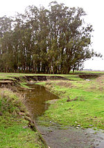
Penngrove is a census-designated place (CDP) in Sonoma County, California, United States, situated between the cities of Petaluma and Cotati, at the foot of the western flank of Sonoma Mountain. It is part of the North Bay subregion of the San Francisco Bay Area. The population was 2,522 at the 2010 census. The area is the site of a historic grove called Penn's Grove; it was formerly a freight station on the Northwestern Pacific Railroad and a center of egg and chicken farming.
Excerpt from the Wikipedia article Penngrove, California (License: CC BY-SA 3.0, Authors, Images).Penngrove, California
Old Adobe Road,
Geographical coordinates (GPS) Address Nearby Places Show on map
Geographical coordinates (GPS)
| Latitude | Longitude |
|---|---|
| N 38.299722222222 ° | E -122.66666666667 ° |
Address
Old Adobe Road 360
94951
California, United States
Open on Google Maps


